Monthly Archives: May 2015

An Idiot’s Guide to Mapping

Ethics:

Open Platform. Open Society.

It was in 2003 that I was first introduced to the Open-Source philosophy by my friend , a political information activist, ex-politician and now life-peer. OpenSource seemed like an antidote to the corporate dominance of the information world and to the invention of spurious or ‘fake’ ideas like this notorious enemy ‘terror’. It was a revolution in global culture, which stopped me in my tracks.

Zimbabwe Missing Maps (13)

In 2015, Google Maps exist everywhere. Much has been made of their use, much of their invasiveness. Academics have long written of the politics and imperiallism of this type of cultural property. Corporate, government and military players increasingly use mapping for different types of aggression – commercial, military (including remote, e.g. drones), and culturally suppressive aggression are but a few of the pitfalls to weigh against the obvious benefits of the entire world being extensively mapped. On a philosophical level, Foucault talks of Power mechanisms which allow rich information-gathering overlords to contain their subjects through control and delineation of their geographical environs – a Geographical Dictatorship, if you like.

But what happens when the maps are intrinsically unreliable, and collaboratively drawn-up, arguably on the terms of the local inhabitants themselves? All this politic changes, and suddenly the process becomes revolutionary, anti-corporate, emancipating those on the ground, and cross-culturally connecting them with counterparts across the world. The collaborative mapping of the world is potentially the most unifying boundary-breaking socialisation project EVER performed by our race. Owned by the community, it resists domination, like the whole of the Open-Source/Platform community, by virtue of its co-operative nature and de-centralised peer-to-peer embodiment.

How it works:

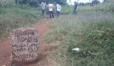
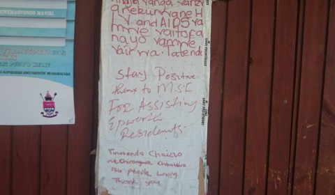
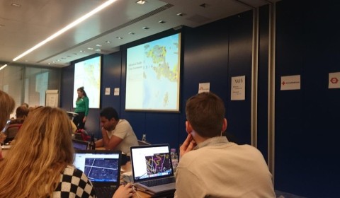
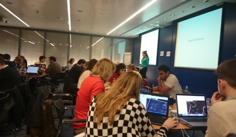
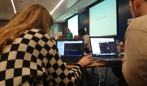
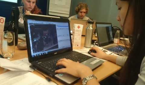
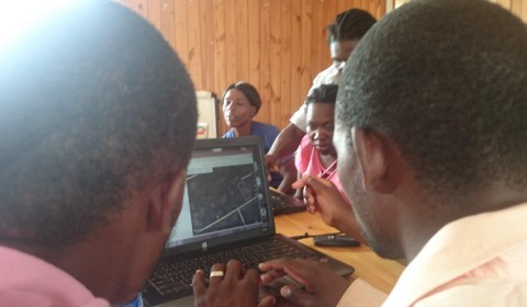
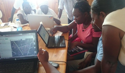
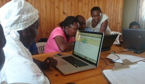
Surf the web to a satellite image of an area anywhere on the planet, but in the Open Street Map browser. You have to sign into this, which involves creating an account. (I chose a conflict-zone which I was familiar with). The planet has been photographed, and the images used are commonly Bing images. ‘OSM users have been given permission to trace aerial imagery from a number of sources. The most widely used imagery comes from Bing, but other imagery is available in some parts of the world; you can choose a source from the ‘Background’ or ‘Imagery’ menu of your editor.’

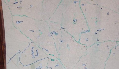
This image can be used in Open-Source applications as long as it is acknowledged. This is the beauty of the whole system. Components do not have to be publicly-owned, as nobody can own the net result. Brilliant. Use a free software package to overlay outlines of buildings and roads better, for them to be numbered and annotated by field-surveyors later. Save it back onto the online- resource.

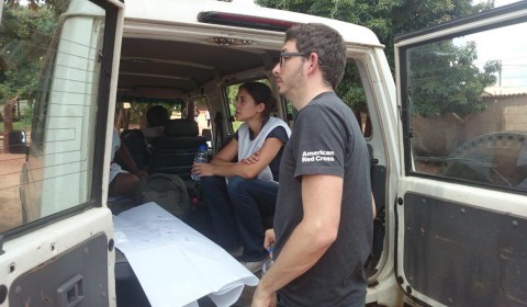
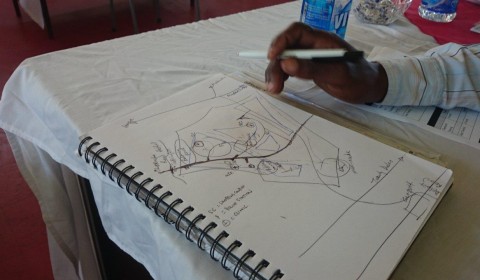
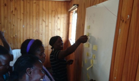
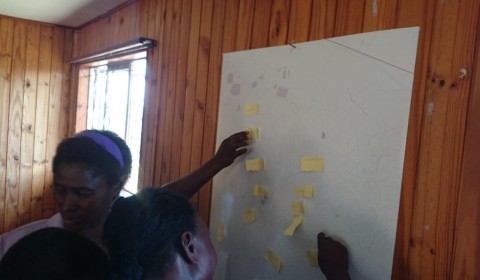
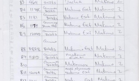
Once the image has your digital tags on (‘nodes’), it is easy to download or print-out the grid-square in the field, and add information to it on a computer, on a smartphone, or on paper (to be inputted later).

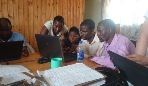
Conclusion that ungovernable spaces are by definition un-corruptible. The last domain of morality. And the radical potential of those who choose to inhabit them. Is there such a thing as economics-free politics. That’s what I  love; the purity. Local and remote people perform all of these actions in collaboration, and partnership with ‘armchair humanitarians’ making a real and tenable difference. Mappings, Projections and Meanings in the sea, the arctic, and the desert landscape are a ‘socially constructed form of knowledge’1  If we concur with this idea of a landscape as  text, then the fact that any map is a ‘blank’ landscape can expose the writing/reading techniques at play in all their varied cultural and artistic representations. We all share in these mechanisms.

Zimbabwe Missing Maps (23)

Open Water – Mapping Precarious Communities For Survival

I recently returned from a mission to Epworth slum, Harare, as a Field Mapping Co-ordinator with the Manson Unit’s Missing Maps project. Here’s a bit of my blog:

No wonder Rhodesia used to be known as ‘The Garden of Africa’. Epworth, a suburb of what is now called Harare (‘Salisbury’ in Rhodesian times), is a visually stunning landscape, but the beauty cloaks a menace. Boulders are piled deep into the geological ground, making boreholes difficult and drainage unthinkable. There is evidence of massive engineering attempts to install drainage abandoned by the roadside. And in the WatSan survey, we are managing to record all the water sources for the whole of Epworth, but to my knowledge, not a single drain. For half a million people. It’s an accident waiting to happen. But at least we now hope to have a significant resilience tool to bring to the crisis when it happens.

Missing Maps Project relies on the idea of The Open Platform, and is a collaborative inter-agency venture. ‘Armchair Humanitarians’ sit at home with an aerial satellite image, tracing lines of houses and compounds in oppressed, ‘at-risk’, disaster zones, making brand new powerful maps which are then filled-in, annotated, by their local counterparts in the field.

We have arrived in Zimbabwe on a wave of well-wishing and a map tool evolved by the ‘developed world’. It feels a bit like a victorian exploration, Speke or Burton, but Open Street Map is not development. Like early explorers, we think, we are bringing a secret from the northern hemisphere, but actually, rather than colonialism, it will actually resist commercial governance or colonisation.   It is the creation of a map, yes, but not one that can be used or abused for financial gain. It is a community map. A bored London commuter and an african tribesman working hand-in-hand to produce a public resource which will save the world. ‘The geek shall inherit the earth’, a well-renowned webmaster friend of mine commented when she heard I was getting involved.

MSF has been active in Epworth for many years, and has seen the head count of those testing positive come down and, to some extent, under control. One of the main challenges with ongoing healthcare emergencies for MSF Zimbabwe is locating patients for ongoing treatment. There are a lot of unknowns. The official head-count is 145,000, but estimates or the real figure however, arrive at potentially 500-700,000. Epworth is a cultural hotch-potch, with a diverse immigrant population, living in a visually stunning but ‘excluded’ suburb. It’s a political timebomb, something of an embarrasment, and as such, this huge ‘missing’ population is subject to huge risks.

Zimbabwe Missing Maps (15)

A map is certainly needed. Google Street Map cars have not visited perpetual war zones or areas of perennial pestilence and famine. Google can’t make money out of these places. So when disaster strikes, floods wash houses away, a cholera outbreak or epidemic happens or even houses get ‘tidied-up’ by politics or warfare, nobody has ever had a means of monitoring or assisting displacement or disease. Until now, that is. Enter; The Missing Maps project. It is easy to see the need for some kind of new way of registering Epworth’s existence to the world. So this is only the beginning of whether residents themselves want to be identified. A comprehensive centralised address system would clearly denote which houses were ‘unofficial’. Pejorative terms like this make all the difference in mapping, but this way, they own this identity. They can change it. We all own the map, as a community.

MSF are the envy of other NGOs for our contact on the ground, but our information, being in essence ‘Associative’, is locked within the memory of our people. On the plane to Zimbabwe, I watched ‘The Immitation Game’. Mulling over the trip, it got me thinking about codes.  Missing Maps is there to create a new code, to put some of our institutional information into data, I reflected. In Epworth, as everywhere in the world, our strength lies in our National Staff. ‘Postcodes’ here are to do with, and protected by, folk memory. The MSF Community Health Workers carry this ‘code’ and enable patients to be traced and treated for multi-drug resistant conditions.

The impact of representational implied value has far-reaching implications. Mapping is an environment where words suddenly become political very very quickly. We have stumbled headlong into these kinds of politics in Harare and it has stopped us dead, but I am convinced that this particular community encryption can work in conjunction with de-centralised online social networks. It is wholly unreliable, legally and commercially, but absolutely life-saving for community resilience. From the core,it only works as in a co-operative way. Whilst there needs to be no consecutive geographical system to addressing, people can be in control of their own address, and, guess what: it can be cascade searched in the software of OSM!

It is really believed that Open Platform challenges the idea of those with the most financial clout having the loudest shout.  For supporters of humanitarian efforts, it is a totally transparent and practical way of donating.

Here’s an observation I made half-way through our time in Harare: I am looking down a well next to the MSF Land Cruiser on the playing field of Maulana Primary School. There are 1631 pupils at this school, I am assured by the Principal, Mrs Maulana hereself. I look up from the well to her face in the sun, and wonder how such a young-looking woman can have founded this well-established school. Everything in the Epworth landscape seems well-established. Huge standing stones surround the ‘playing-field’. It is like a mega version of Stone Henge. A lunar landscape. You can buy twenty trillion Zim Dollar notes on the market for a fiver as souvenirs, which are decorated with these famous stones; the national monument. Ostensibly, this designated ‘slum’ should also be an UNESCU world heritage site. Maybe it is, but because of its uselessness for serious development because of its ‘rock-pile geology’, it has, ironically become over-settled by transients.

Certainly, what I had presumed to be a project ‘taking technology to the Africans’ is working out in a very different way indeed. In Epworth, people clearly accept the ‘ in development’ process so much more readily than the panicking idiot in front of them. As I instruct on Open Street Map, I look around me and see calmness in my companions as my computer crashes once again, or some piece of software proves ‘in development’. It has become very clear that I am not here to teach, but to learn. Whilst I tear my hair out wanting everything set in stone, these guys who are so used to unknowns are quietly busy fluidly learning yet another aspect of their future world, and rapidly turning into technicians who will soon outskill their overlords. The geek shall indeed inherit the earth. The African Geek, probably…

Harare

I’ve got a headache. It’s 3pm in a darkened room in Harare. The sun is beating down. A cool breeze blows outside the windows, but the curtains are closed. Children are playing in the street, but we are inside, staring at computer screens. Tomorrow, we will try to describe Missing Maps, and in fact the whole Open Street Map concept to a group of health workers in Zimbabwe. It will become readily apparent that we are there to learn, rather than teach. But we do not know that. Yet.

I have had the great idea that we should print out a huge map of Harare, so that we can explain how we will take squares from it, one-by-one and annotate them, ready to upload the updated humanitarian information back up to the internet. As an MSFer, a career Field-Worker, and Visual specialist, I am fascinated to be part of the Missing maps project. But I have a lot to learn.

To an idiot like me, printing-off a page from the internet, even if it has very fine detail and needs to be high-resolution, seems obvious. But it isn’t. After weeks of work by international volunteer mappers all over the world, a schematic ‘basemap’ – looking like digital tracing paper – can be found online. Having helped finishing it off at a ‘Mapathon’ a week earlier, we can see it now online from Harare. We can zoom in to the shapes of the nameless houses and schools. We can change it with Java Open Street Map free software. But we cannot make a hard copy.

‘Surely, hard copy is fundamental?’ I’m showing my age, and feel like a dinosaur. If I want to know WHY it works, everybody looks at me blankly. I’m used to image manipulation, and consider that an image is of something, and can be rendered by different processes. Transparency and accountability are all very well, but now, things are falling apart around this table, around this course, around us. We should be able to print everything we see on the internet. The explanation comes that this is a map of the world, and in its infinite detail, to print this map is something like trying to print a picture of the universe. Kieran, my GIS expert, seems completely unfazed. He seems to be enjoying it. I have much to learn. ‘But it doesn’t work!’, I agonise. Kieran is looking at me as if to say: ‘Shut Up’. After about twenty minutes doing whizkid stuff, he does: ‘Just don’t worry, Rupert. Leave it to me’. I met Kieran, a Red Cross GIS technician, at the Mapathon and, with the encouragement of the ‘tutors’ who were running the ‘Mapathon’, learned basically how to use a software which is changing the landscape of humanitarian relief forever.

But now we have very limited WiFi. It is Sunday in Harare, not tuesday in London, and it doesn’t feel like we are changing anything very fast. Both of us have computers which are objecting to the heat. Or something. It has been a gig, last-minute push for me to try to prepare for this work. I am over-complicating things, and I know it. Swamped in new technology, I am a nervous wreck.

‘We really need this map.’ We both say, almost in unison.

Eight o’clock rolls up. We have 12 hours to go. ‘We’ll just put it out there. Somebody’ll build a Jpeg of it.’ says Kieran, finally. We have missed the best of the day, and most of Britain will be turning in shortly. They are about five thousand miles away. But Kieran’s calmness is reassuring. How does he do it, I wonder…

We are ‘remote’. Or are they ‘remote’? Depends what you call reality. We both agree that somebody, amongst the worldwide community that made this very map from aerial images and sheer hard work will like the challenge of creating a document we can print from their map. The software doesn’t do it, because it hasn’t been needed up until now, and it is free and by nature experimental.

By ten o’clock the next morning, Kieran rocks into our briefing in MSF’s Zimbabwe Headquarters. He is beaming, clutching a memory stick  and a huge AO -size ‘blank’ map of Epworth, fresh from the printers we have found, improbably close to the MSF safehouse where we are staying. A massive, finely-detailed AO-sized poster of our entire suburb. A map of Harare, manifested in the flesh for the first time, made by volunteers from their own homes all over the world. Made into a Jpeg image by a bored GIS whiz on another continent in the small hours. Printed out on a back-street of Harare. This is a true ‘Co-Op’. The Open Street Map community. It all exists in windows and layers, it seems. Across cultures. In London, we are dealing with a layer of data on top of a satellite photo of the area. We are making a trace. A load of London City-dwelling volunteer humanitarians with an interest in computers and skills in GIS. The geek shall indeed inherit the earth. We are ready to map…

Then it is five days later, and I am walking through the neighbourhood of Glenwood, Ward 6, down a footpath, with farms across veg plots on each side. Chipo, Esther, Landiwe and I hear quite a noise up ahead through the grasslands. It is idyllic, and hard to think of the place as the precarious ‘slum’ described in the briefing. But the grassiness and tranquility belies the fact that there is no water here a lot of the year and, perhaps more importantly, no sanitation. Not a single drain.

Indexing this map through the eyes of the mapper on the ground, we round a large tree with our printed-out section. The source of the ruckus becomes self-explanatory. It is a small farmyard, woodsmoke spilling out, decorations on the whitewashed walls, and not a soul to be seen. Motorbikes clog the entrance, and we look from outside at the way the place is held together. But the Zim DanceHall is blaring out. I struggle not to move as music pushes through the fug of woodsmoke. Somebody is having a party. We stop to input the data onto our Map Form. Name of house. Use: Residential. I hear the music and think of nightspots in carefree London. Then I think of the mapper in that West-End office that night who traced this particular building in readiness for us to be standing here, the ‘colleague in the field’, inputting data.

As I walk along I am swaying to the music, and we are all laughing about my rhythm. We put the house on the field paper. But I wish I could go in, and as we move onto the next data entry on the form, and I squint at the GPS arrow on my Android Screen, I am reminded of Robert Frost’s ‘The Woods are lovely, dark and deep, but I have promises to keep, and miles to go before I sleep’. I linger, but the others are already noting down the next settlement on our massive list. We have mapping work to do. I am starting to think differently. About layers, about maps, about addresses. I hurry onwards between the boulders in the Savanna grass.