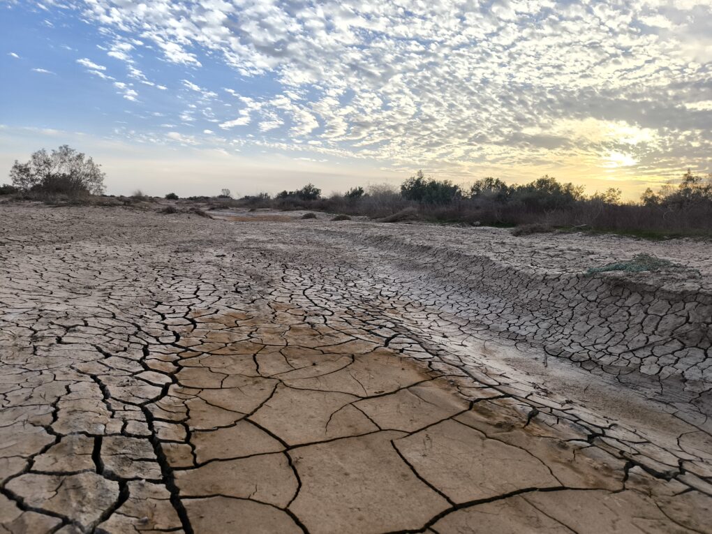
The Desert Oasis of Al Azraq, Jordan, once a verdant wetland, with ‘shining pools’ (T.E. Lawrence)
The Jordan ‘Community-Mapping Climate Memory’ project aims to help local people map how they and their livelihoods are adapting to extreme and accelerated climate change. In Al Azraq desert oasis, OpenStreetMap (OSM) is getting used to record cultural practices as a living archive of usable community assets. The project draws on a legacy of OSM projects mapping critical resources, traditional coping practices around these, and the narratives that link them. Our mission is to establish a common frame of reference for multi-ethnic cooperation, to manage diminishing resources in a place where the same landscape has different meanings for different peoples.
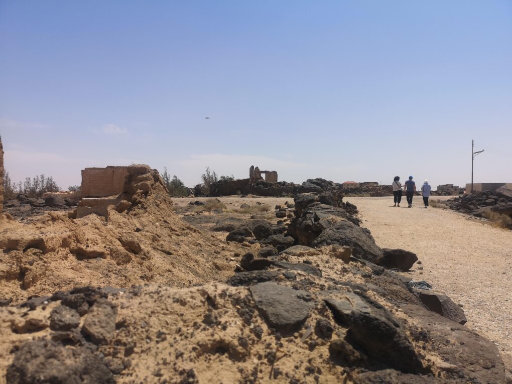
The now deserted fishing village of Al Azraq (Old Town)
Our Community Mapping team is adapting methods used in humanitarian scenarios, where emergency and development resource management has benefited from community input, to connect climate science with hyper-local lived experience. By leveraging OpenSource Community Mapping methods, the community will have an ‘auto-ethnographic’ hand in practical, participatory solutions to climate-affected issues in their immediate locale. We hope that citizen science can record this visibly-unfolding climate crisis, promoting cultural visibility and local economic resilience. Convening Princess Sumaya University (PSUT) YouthMappers, OSM Jordan, and the national Wikimedia foundation as collaborators, we hope it will create a national precedent.
The Beginnings: “showcase” uMap of Al Azraq community profiling. This geo-indexes community wikimedia content through OpenStreetMap links. It’s all in the Public Domain (Credit: OSM Contributors)
It’s an exciting project, not least because of the location, amongst the desert castles and pathways of the Arabian Peninsula, steeped in history and visually stunning. OpenStreetMap Community Mapping is, by definition, adaptive. It bolts together different elements of OpenSource knowledge and tooling to suit community needs locally. This project is no different. It’s experimental. Much trialing and consultation time has been necessary to create a unique and innovative methodology for the particular needs of this culturally-diverse region. Connecting OpenStreetMap with what I’m calling ‘The Wikisphere’ seems to clearly resonate with these communities.
Why Azraq?
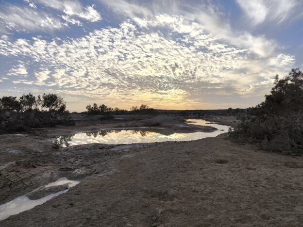
Around the world, hyper-local connections with the land have been slowly occulted over the past few centuries by the rise of industrial agri-practices. In Al Azraq, this has happened within three decades. The loss of age-old livelihoods of fishing, growing, trading and herding has led to economic deprivation, but this sudden and catastrophic change has been accommodated by the communities in creative ways.
Measurable documentation of human resilience in the face of change may provide unprecedented insights for wider sustainable changemaking. Recognising the cultural significance of Al Azraq, these insights, we hope, can be extrapolated as a regional exemplar of how local issues bear on the wider global climate change agenda. Social capital remains strong in community memory here, and the story and heritage still linked to the landscape can give better public understanding of both vulnerability and resilience in these under-represented communities.
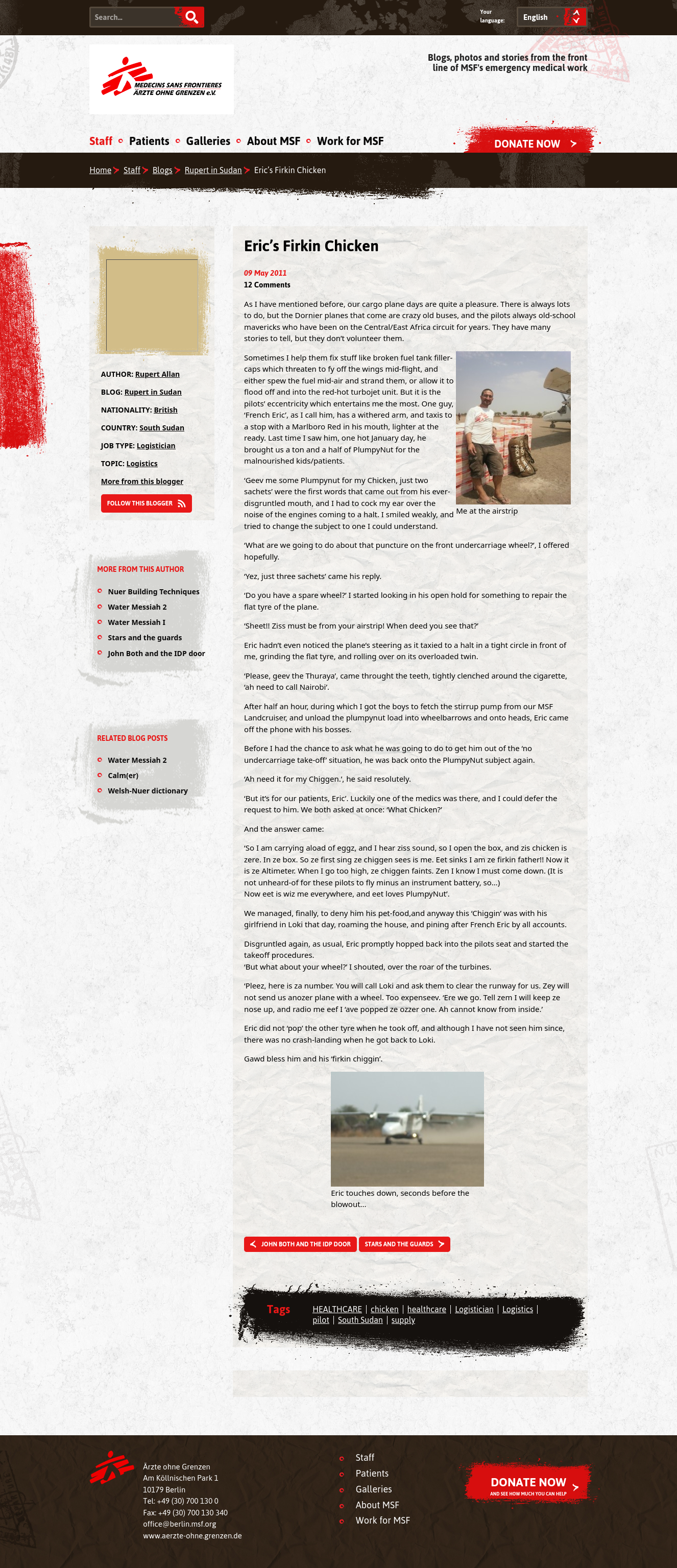
The receding wetlands: faded environmental grandeur – a paradigm for the planet
Al Azraq is in the Black Desert, fifty miles East of Amman, in modern-day Jordan. Lawrence of Arabia was Headquartered in this formerly beautiful, verdant oasis. Historically, it holds major national significance for Jordanians. The area is surrounded and embedded with layer upon layer of history and culture. Yet visitors to Al Azraq may be surprised even to find more than some tents around a ruined castle. Google shows one or two hostelries and some commercial entities, some buildings, but as a prime cultural site and destination, Al Azraq seems invisible. One tourism page even reads: ‘The town of Azraq itself is small and does not offer anything of particular interest, apart from the nearby castle’
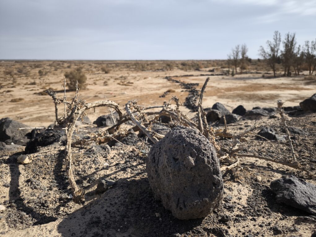
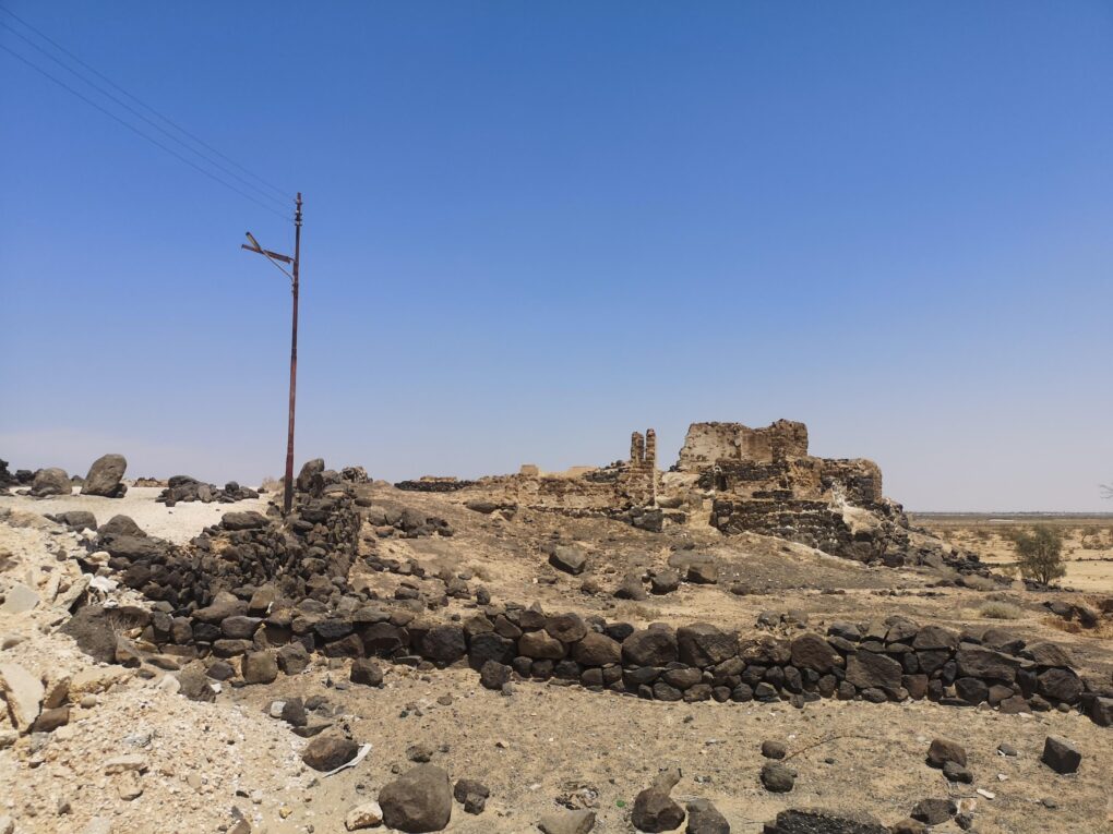
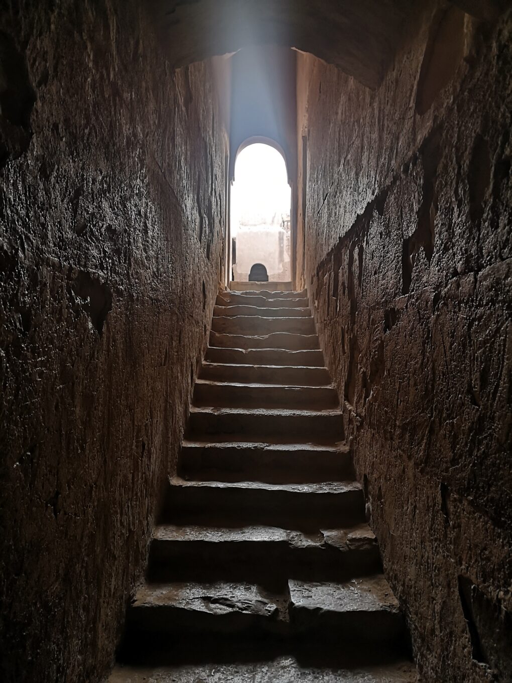
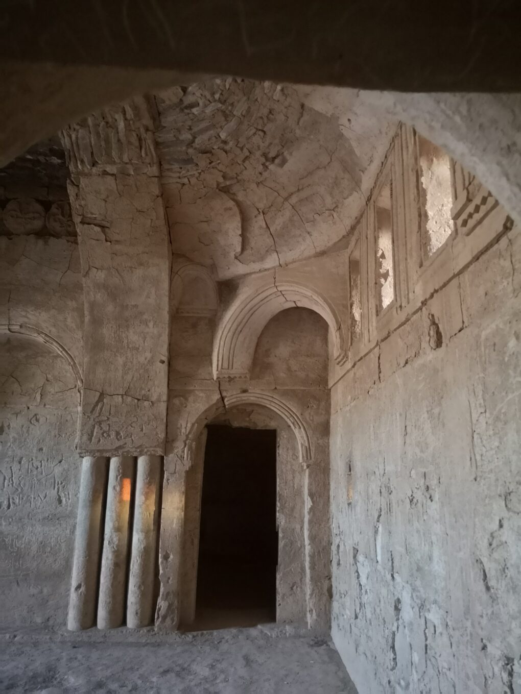
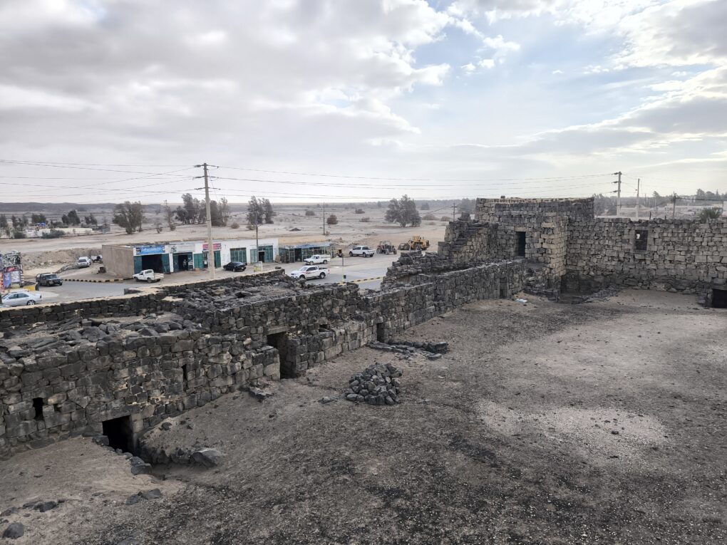
Azraq’s Castle is famous, but other desert castles also litter the area, even in town, with stories of buried treasure, wild animals, hunting and desert skirmishes infusing every street corner. These stories are the real character of Al Azraq. They are hyper-local folk histories about rituals and technologies which are in danger of being forgotten.
Desert Castles and Hunting Lodges punctuate this once opulent area, famed for its big game hunting and biodiversity
Operations:
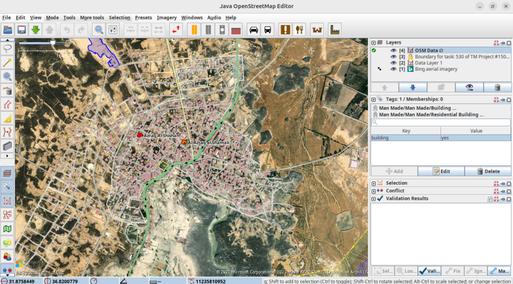
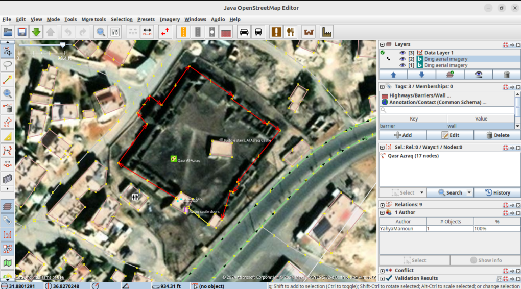
Our project proposes that a visualising something different than western tourism interests could help Azraq survive it’s particular climate crisis. Something that the community can own, edit, and develop for themselves. So for the past months, in an organised editing campaign, we have been creating a ‘basemap’ of the area. From scratch. This is now ready for data to be added from the local community.
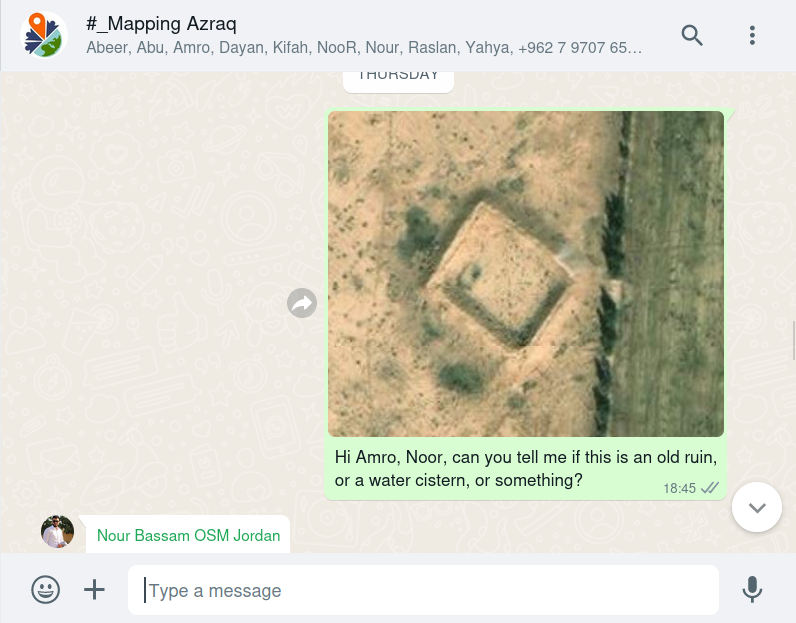
Remote mappers global WhatsApp group: knowledge exchange to help remote mapping
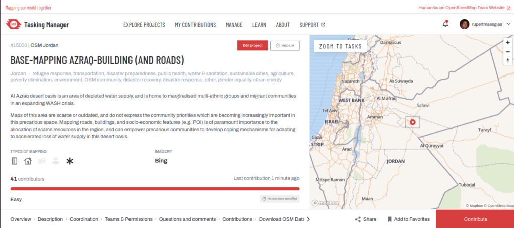
A team of multi-national OpenStreetMap volunteers have been drawing around houses and roads on satellite imagery, to create a ‘base-map’ of every building in Al Azraq, as digital shapes. We created a mapping task for Al Azraq, on the global Tasking Manager platform run by Humanitarian OpenStreetMap Team. Accompanying the task are instructions, and documentation is maintained and updated on the OpenStreetMap wiki. Edits currently represent contributions from English, Scottish, Welsh, Lugbara, Luganda, Druze, Bedouin, Syrian, Palestinian, and Sheshen origins. I may have missed some!
HOT (Humanitarian OpenStreetMap Team) Tasking Manager – Organised editing from the global community (IMAGE: HOT OSM, OpenStreetMap Contributors)
OpenStreetMap
OpenStreetMap is particularly good for visualising hyper-local human-based interests by enabling community visibility through measurable ‘home-made’ GIS data. Community Mapping can be used by communities to represent their needs, assets and cultural capital, and thereby to have a say in their own resource allocation.
Remote Mapping of Al Azraq – tracing buildings from Satellite Imagery (Credit: JOSM/OSM Contributors)
This is the first time that a whole town has been comprehensively base-mapped in such a way in Jordan, and it represents a progressive regional first, allowing community-led Open Mapping to shape a field-derived research agenda at national level. Jordan enjoys a reputation for multi-ethnic unity, and it is exciting to feel part of this agenda, connecting such diverse local interests with global development themes.
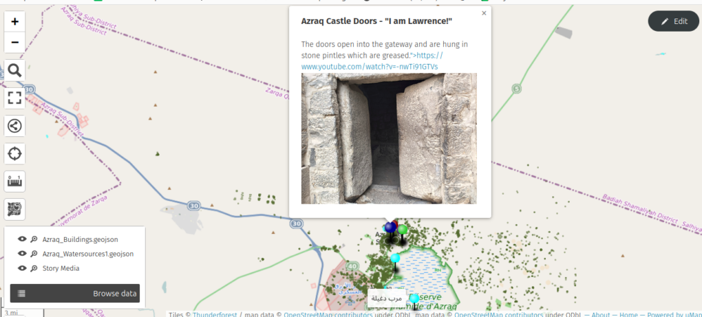
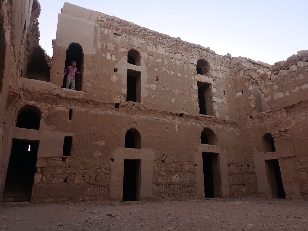
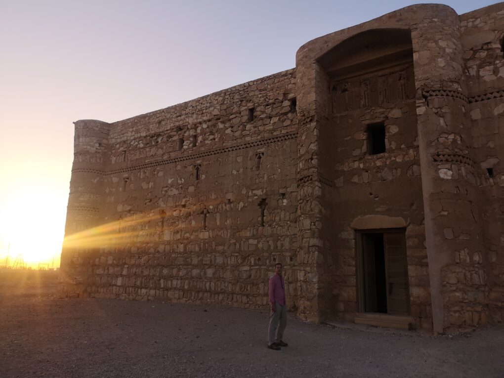
Quasr Al Azraq/Al Azraq Castle – Former wetlands clearly visible beyond the road. Within living memory, this once verdant landscape has become desertified, due to climatic and human-influenced changes.The ancient fortified desert castle of Al Azraq – possibly Pullman’s ‘Blue Hotel’, certainly Lawrence’s Headquarters, predating the Romans by milennia
We have now been remote-mapping for some months, and Dayan has been helping from Uganda. It is a truly intercontinental project, and exciting to convene trainings where his refugee-mapping expertise is supporting the team from a small rural house on the South Sudan borders. The brand new community map now appears in phone Apps like Maps.Me, AllTrails, AppleMaps, TomTom, anything using OpenStreetMap.
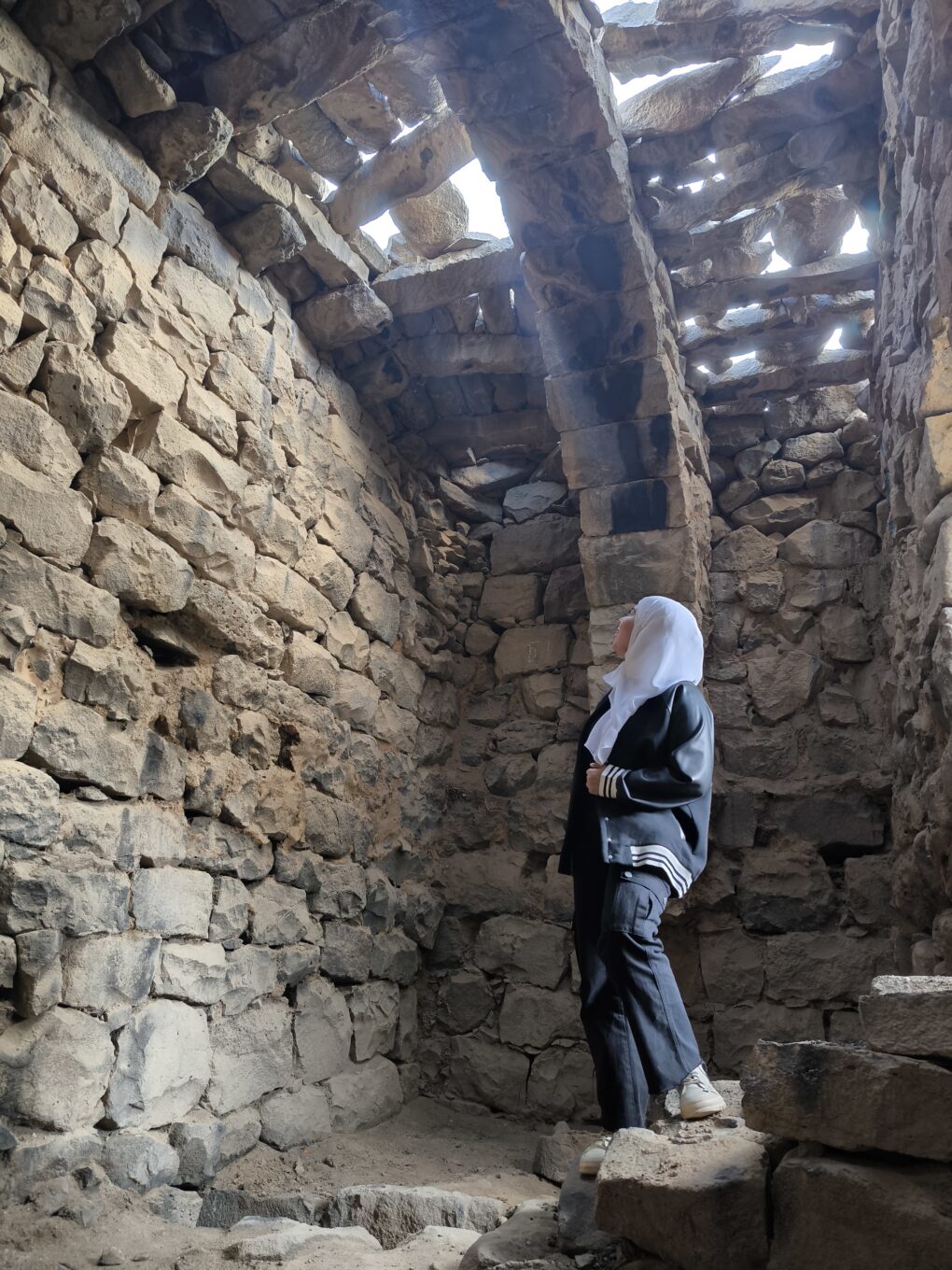
The spectacular stone beams of Al Azraq Desert Castle
And on the ground, we are starting to gather a collective of “Practical Community Mappers” across local communities to record land-based skills, history, and lived experience. Place-based practical knowledge is still embedded within living memory in Al Azraq. It is an intangible heritage we can still access, representing remnants of a self-contained local economy. People still remember how this worked.
The beginnings of the Levant’s first OSM Field Mapping team.
The aim of this project is to leverage a rich history of rural resilience, agility and inventiveness; to help Azraq’s people express socio-economic and cultural visibility, but also to create actionable methods for future generations to have a pro-active voice. To help create this science communication capacity, we have the privilege of Prof. Iain Stewart’s expertise leading the project. As broadcaster, science communicator and geologist, Iain has centralised community-owned data in his research agenda as UNESCO Chair at the Royal Jordanian Scientific Society (RSS).
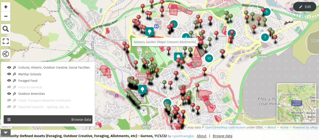
Wellbeing, Resilience, and Food-Desert-mapping. With Humanitarian OpenStreetMap Team, NHS Wales and Missing Maps/Medecins Sans Frontieres. PRESENTATION and REPORT
Community-led data helped to map wider determinants of Wellbeing, Co-morbidities, Social Exclusion and outbreak vulnerability. Reconnecting the NHS with its communities in the birth-place of the NHS (and of the Labour Party).
We adapted Motorcycle Mapping methods previously used with Medecins Sans Frontieres, Red Cross, UN, African Health Ministries and INGOs to use for mapping social inclusion, outbreak resilience, climate justice and lived Wellbeing experiences. Based out of Twyn Community Hub, Mel, Michael and Amanda were our community Disaster Risk Reduction mappers. Walking miles of Merthyr, they interviewed for perceptions of need, food and social access, and community assets. They then surveyed infrastructural provision realities site-by site. The reports created cultural, resource-access map layers, profiling a rich social capital, a proud pre-industrial heritage, (including ancient mythologies/holy sites), and the qualitative relations between perception and reality in the community voice. All available in the public domain, these anonymous data are your pocket, on all phone apps using OpenStreetMap/Mapbox etc wiki-maps.
Doctoral Research – Is all Geography Psycho-Geography? Exploring the post-digital decolonisation of navigation and plural cultural geography amongst Seafarers, Boatpunks and Refugees: Discussing blue ontology, recycling, and ocean citizenship in our era of global migration.
This project embarks from the observation that ‘maps are never value-free images’ (Harley in Cosgrove and Daniels, 1988) and that when we map there are preconditions embodied within the process. Critical writers from David Harvey(1973) to Edward Said(1979, and 2000) clearly make the case that all traditional mapping is not only conditional but also colonial, and a technology of spatial and personal governance.
This study is fundamentally interested in the relation of language to technology and the approximations of legend intrinsic to it. Using collective mapping as a model, it is compelled by a critical discussion of humanitarian interventions which use digitally-enabled mapping apparatus to collaborate with – and in – the field. Humanitarian OpenStreetMap is one methodology of digital humanitarianism which is heralded as ‘democratic and emancipatory’, despite criticism of some, whose ‘effect on public participation is more limited’(Givoni; 2016, 15). Initially, this PhD seeks to question whether collective digital mapping dissipates or further enables an imperialist mode, exploring specific mitigations for the Missing Maps project not only because of its reliance on hermaneutics, even affect at both ends of the technological interaction, but because the ‘shapeshifting’ toolkit used is dictated by field-specific demands (lo-tech and hi-tech). Cultural Geographers studying ‘geosophy’ (Wright; 1947) have long considered maps as socially constructed and ‘embedded in specific social contexts of production [and use]’ (Glasze and Perkins; 2015, 144). However, the passing of authorship and method into the public domain creates this phenomenon in the plural. It resets the psycho-geographic parameters, and evokes new suggestions about the speed and power of how reciprocal understandings of space work.
The PhD aims to apply this ontology of collective mapping and its determinants to a contested space – the sea. The sea is used because it is fluid; a socially constructed space, whose changeable landscape features are supplemented by technological, mythological and legal descriptors. It is also a common space whose conception, navigation, and innovation can be assessed from multiple cultural perspectives. By investigating this act of visualisation in a culturally abstracted setting, it will be possible to analyse close readings of the ways people ‘produce’ passage and negotiate cultural imaginaries or ‘legends’ within the spaces they project.
The research considers how people ‘(re)produce certain geographies and thus social realities’ (Glasze and Perkins, 2015; 143). Literary criticism suggests an instructional influence of common literary tropes or narratives, such as heroic quest, adventure, discovery, utopia, wilderness, the sublime on lived experience (Frye; 1958, Olderman; 1972, Dundes; 1965). Examples on the sea include personal accounts of navigations influenced by those who Conrad calls ‘knights-errant of the sea’ (1896, 3), accounts whose factual and technical approximation are an acknowledged theme of the ‘unreliable maritime text’.
The claim of the thesis is that the ideologies and cultural ‘truths’ projected onto the synthetic reality known as a map can be identified as properties of comparative cultural discourses, with traceable origins in literary text, behaviour and form. It will seek to establish the extent and influence of such tropes on design solutions in crisis settings. By comparing examples from differing cultural traditions it will explore the potential of cultural mythology to augment technological innovation. The work will consult approaches to mapping/populating the sea from contrasting economic, political and social viewpoints. The intention is to expose common systems of signification implicit in technical innovation through the specific technique of making maps. It will seek self-conscious examples of ‘materialising ideas’ of Utopia within technological change, and gain insight from cultural approaches acknowledged to identify with technological reform..
The humanitarian field is an environment in which representation, negotiation of terms, and practice of codes can be as critical as it is on the sea. By demonstrating the process of meaning-making through this abstracted mapping process, the case study aims to explore the dependence of scientific exactitude upon cultural form, and the impact of creative collaboration on humanitarian crisis technology.
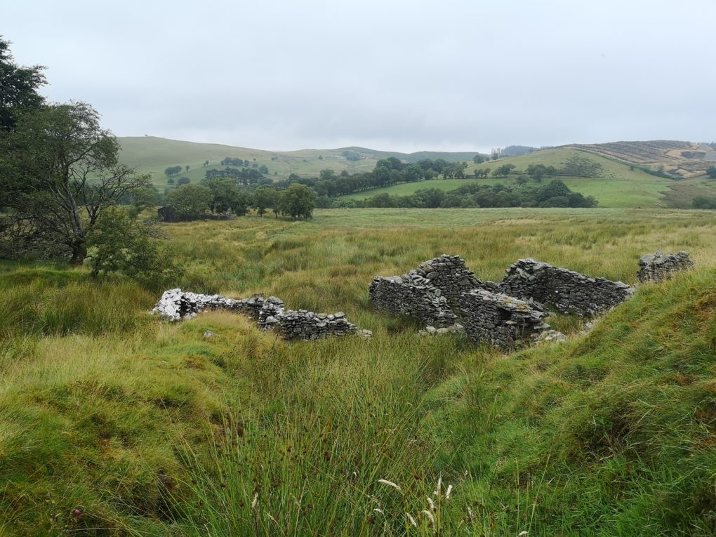
Who knew that there were crofts hidden in the hills of my next-door village in Wales? I didn’t until very recently, when we started listening to the British Library/National Library of Wales sound archives collection.
Dai Morgan, the Horse-Boy
I mean sure, Dai Morgan used to lean on the garden fence between our houses and tell me stories about running away with the mountain ponies when he was a young horse-boy. So near-by and yet, in another village. Dai used to point over towards the north side of the Ystwyth Valley and, conspiratorially, quietly say, ‘they’re different, those people. North Wales, you see. They think differently’. Less than a mile away.
Dai also told me a story once, about when he had been a Gwas (households had several of these ‘farm servants’) as a lad. He was a horse-boy, and was fascinated with the personalities and breeds of the mountain ponies, which, he said, were four types, which never interbred. He was convinced of this, saying that the original Cardiganshire ponies were russet, yellow and grey, all with white flashes on head and hoof. One day, he was in a far field of the farm in Bont, when the wild horses came down to the fenceline. Dai managed to coax one close and jump on. It bolted and he clung to its bare back, as the whole group of them ran back into the mountains. On and on they ran throught the night, until they came to a small upland stand of trees by a deserted stream and suddenly stopped.
‘It was their home’, Dai explained. ‘I was able to jump off, but it took me hours to walk back, through the night, and I just arrived in time to dodge trouble and do the milking at 5am.’
I can see it now in these crofts. They had a local perspective. And even though hill-people were mobile – many even lived away for a few years and worked in London – that was most certainly a foreign migration, reminding me of the London Kurds or Portuguese.
When they were back on their lands, it was exotic, too, for Nant Stallwen to marry into ‘Llew Goch’ (meaning: the family running the pub in Bont). It was 10 miles away, if that. Such households were known as communities in their own right, and would turn up to events as an geographical entity – Nantrwch (stream of the sow), Maesglas (blue field).
We’re listening to these interviews whilst we sit and draw. Mountain voices. Some coughing, laughing, straying from the question. It’s a very wild but intimate feeling as the rain speckles your face and you imagine similar tactile experiences in this space 60 years ago.
Interpretation of Tom Morgan’s description of life in the Crofftau (Rupert Allan – YouTube)
When Peggy Maesglas from (Soar y Mynydd) was diagnosed with Hiraeth as a boarding school pupil in Tregaron, her family left the farm-hands running the farm ‘household’ and moved down to town to give her the support she needed. These were close communities, and Peggy also remembers that Nant Stalwen farm would have two or three thousand sheep shearing, and over 100 horses would be gathered, as all the shearers from the hill farms around – men and boys – would muck-in.
When chapel was on, and the preacher visiting for the weekend, again there were horses. Hundreds of them, grazing the near bog. As well as a chapel which was taken to Bala on the back of a lorry,Tom Bronant tells of breaking the ponies in record time by doing on the deep bog, where they would tire much quicker than back in the lowlands.
Tom’s recollections of Caio Evans leading the Free Wales Army on horseback manouevres up on the Devils Staircase and around Llyn Brianne are coupled with tales of all the ‘bois’ grabbing a lorry in the middle of the night in Tregaron, and coming up to sing outside Nant Llwyd, to see off a bride-to be. They turned up some time after midnight, and even the dogs were scared by the noise! The lights at the farm went on, the doors opened, and they were welcomed in to party forester-style into the small hours.
And ‘Nant Llwyd’, as a household, were legendary, with family and gwasau (farm-hands) comprising a formidable force when it came to horsemanship and community events. But it was Peggy Maesglas who features as the ‘man vs horse’ competition champion, and known for the finest horsemanship in the area, she could get back from Tregaron to Soar in less than an hour, if she hurried.
The reputation of Caio, and his character, are easily forgotten these days, As is the very comprehensive threat which the FWA implied for Westminster. Caio’s leadership and physical presence comes across in different accounts, though, and he was clearly universally admired – almost like (and contemporaneous with) Che Guevara. Organised and agile, his well-put-together group seems revered as a not inconsiderable guerilla force. And the hills, unroaded but easily-navigated by skilled horsemanship, must have presented an important dilemma for the antiquated machinery of a threadbare post-war english task force.
One of the independent flags of Wales, at Castell y Bere (CC BY 4.0)
These landscapes are boggy and hard to navigate. But roads – even tracks – were less important when you consider that everybody had a horse which could graze the mountain grass. Free fast transport for everybody. And Peggy Maesglas says that the roads that the forestry brought in destroyed the communities. The sound archive research continues next month, with Stories of the Forest from Soar y Mynydd and Nant Doethie.