Author Archives: Rupert Allan

Refugee Community Motorcycle Mapping, South Sudan Border Regions

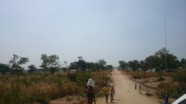
Tents as far as the eye can see…

Introduction
As Humanitarian OpenStreetMap Uganda, our presence in the country involves two arms of activity which are the benchmark of the OpenStreetMap democratic ethos. These are Capacity-Building (Training) and Data Collection (Mapping). The partnership with USSD allows us to strongly pursue these aims in with significant impact, amongst refugee and host communities in Northern Uganda.

We train partners and community members in the tools of OpenStreetMap (OSM), a global online ‘wiki’ map empowering under-served communities in technological skills, and increasingly used for humanitarian relief. These participants have local knowledge and techniques which they can bring to the mapping process, giving ground-level information about how their communities are served for amenities.

During the month of November and early December, HOT conducted field training, classroom training, and field-mapping amongst communities in the Refugee-Hosting communities of the Arua District. This is part of an ongoing HOT project, funded by the US State Department, called ‘Crowd-Sourcing Non-Settlement Refugee Data’, and locally referred-to as ‘HOT Uganda Community Mapping’. The project aims to identify Key Geo-Spatial Indicators of need and resilience amongst and between Refugee Settlements and Hosting Communities. Click HERE for some interactive OSM maps of our work in Arua District.

Background
This is a report on the first three weeks of field mapping operations in Arua, the first of the northern districts of Uganda which HOT intends to map. Arua has a complex refugee community where refugees live in settlements as well as amongst the community.
The management of this project, to which partners and even community members are encouraged to contribute, focuses on the collaborative integration of different datasets. These are across sectors and agencies, and are all brought into an openly-shared resource: OpenStreetMap. Data is mainly collected through lightweight Open Source Smartphone apps. We teach users to install the apps, design surveys, and use them in the field. The outcomes are both data-collection and ongoing support in the use, sharing, and manipulation of that data.

Project Objectives
1) Data collection: To ensure transparent and coordinated service provision through authenticity and collaboration with local communities.
2) Capacity-Building: To initiate a two-fold approach of enabling partners across sectors to adopt OpenStreetMap conventions, methods and tools into their own workflows (by training and ongoing support) and by initiating field-mapping data collection at community level, engaging members of both Refugee and Hosting communities on the ground.
3) Sustainability: to Create a Pilot Model for Ongoing Work. Because of the way community mapping can give a field intimacy missed by ‘top-down’ NGO ‘partner’ surveys, we can show a very granular technique for accountability and gaps in critical service. There are many agencies in Uganda who recognise the need for this. This project aims to showcase this technique.

Mapping Objectives
Goal: Field Mapping of Camp and Non-Camp Refugees in all hosting sub-counties, to record Geo-Spatial Indicators of gaps in service-provision to precarious communities.
How:
Universally Conventional Map resource creation
Data collected: Community Characteristics (Population, Movement, WASH, Health, Education, CBI, SGBV Risk Indicators, Refugee Livelihood and Movement.

Training in the Community:

The first training day, held in the field at Omugo Subcounty Offices, was used as a training in data collection and as a Surveyor selection process. All the usual challenges of Field Mapathons were expected and encountered, including generator and ‘MS Windows’ issues, water and rural access to WiFi (mass Smartphone tethering used, as the most secure, contingent and accessible method).
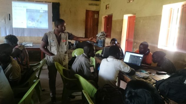

HOT Uganda team manager Deogratias Teaching Tasking Manager to Refugees and Locals
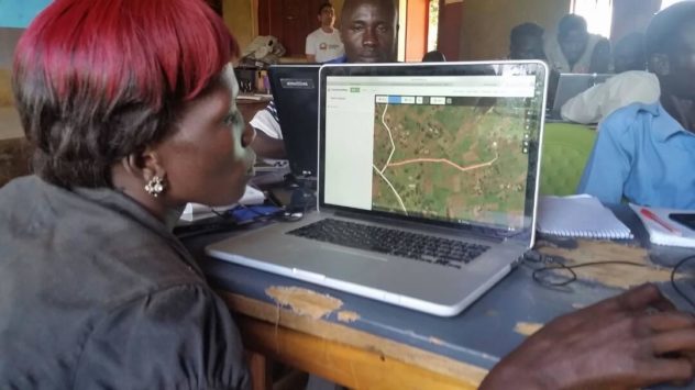

Viola (Refugee Community) and Jabo (Hosting Community) editing their own home data in OpenStreetMap iD editor

Participants were introduced to OSM data collection in the context of their own community needs, with the intention that this would build an accurate map which addresses presence of WASH, Education, Healthcare, and Cash-Based Intervention amenities in relation to both host and refugee communities in the district. 55 people participated.
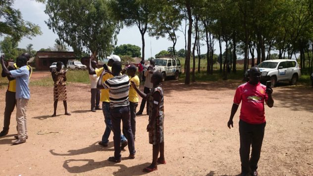

Surveyors Learning OSMAND: how to identify ‘Blue-Dot’ offline Satellite Position on their Smartphones using OSM for Android

25th November 2017, Field Mapping Inception Starts
Data collection was implemented the next day with the selected candidates. This continues to date. Complementing this exercise is the continuation of OSM Open Workshops and Mapathons, which bring GIS professionals together to work and learn side by side with local and refugee community members.
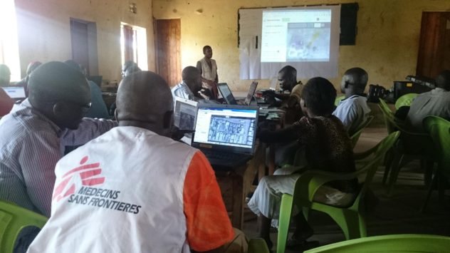

Mapathon: MSF Water & Sanitation Expert mapping in collaboration with community members
The first ongoing feedback event was held on 28th November, for which data collection was suspended, for surveyors to attend. This was conducted, too, in the field, and involved the usual challenges and rewards of field-based mapathons. It demonstrated the field-based inclusive ethos of HOT, and the presence of surveyors and their data clearly cultivated the sharing and integration of data and knowledge between agency and field, and the understanding of the collaborative and field-derived data ethos as a whole. (37 people participated)
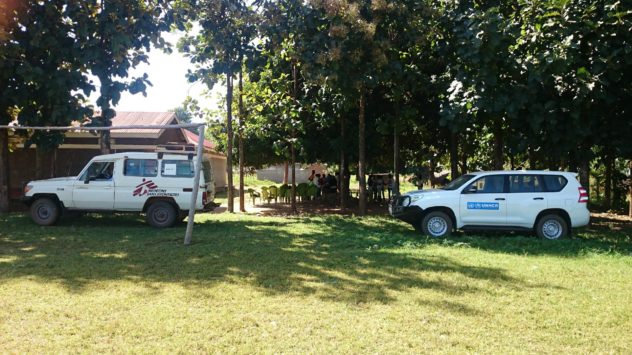
Omugo Sub-County Field-Mapping Training – Unusual collaborations between participating agencies

Strategies of data collection continued to evolve, as the twelve data collectors moved around the district in-between this and the next ‘Mapathon Training’, which was hosted at the UNHCR regional office. This is a field feedback session, where surveyors share thoughts on relevance of survey questions, based on field experience and community feedback. They are later taught how to modify and write such Open Source surveys for themselves.

6th December 2017 Mapathon Training, UNHCR Regional Office.
This was a standard OSM training day, tailored for some requests for certain preferred topics and tools. The schedule included Tasking Manager, ODK, KOBO, JOSM, QGIS and Form-Building. All members of the training completed the process of composing a map by the end of the day. Appendix 3 Day Schedule.
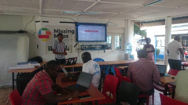
UNHCR Training, Arua
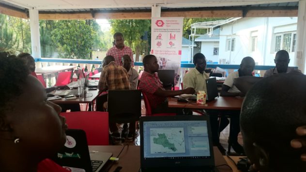

All Participants Compose QGIS Map Products of their home environments.
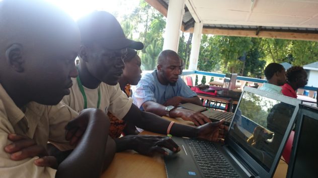

Left to Right: Host Community Member, Refugee, Local Board LC3 Officer, MSF WatSan Officer.

Refugees, Local Community members, and Partners learned tools together in the classroom environment. It was a very rewarding day, fertilised by the field data and mapping experience of the Surveyors, and the cross-referencing of GIS and Data skills which was gathered in the training.

Field Mapping Strategy and Methodology
Mapping strategy is a very important part of the surveying process, as productivity will be halved immediately if progress is not made through an area in a constructive way. A detailed and commonly-understood plan is needed to avoid duplication and repeat surveying, for which local roads need to be known.
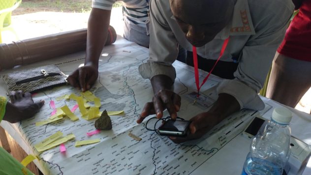

A freshly-trained Field Mapper strategising with field-derived community feedback

During the planning phase, we were able to access shapefiles of counties, subcounties, parishes and villages from the Uganda Bureau of Statistics (UBOS). This was data which later led to challenges, but was useful to overlay on maps showing settlement shapes (from the UNHCR), and which we used to strategically plan surveyors’ workplans.
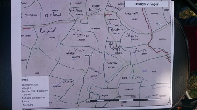
Daily Area Coverage – Boundary Shapes Courtesy of Partners: Uganda Bureau of Statistics

The overall map of the area for strategy helped, too, to plan a longer-term strategy. These working maps are consistently printed and used in the field by surveyors. Dark areas denote refugee settlements. Below is an example:
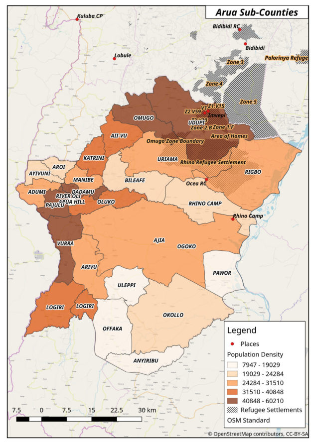

(Map: HOT Uganda. Not for publication)

Motorcycle Mapping
Collaboration takes place through occupational engagement between all participants, and the Motorcycle Riders themselves are encouraged to learn and participate in the process, providing a number of fundamental assets to the table.
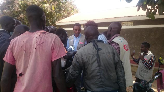
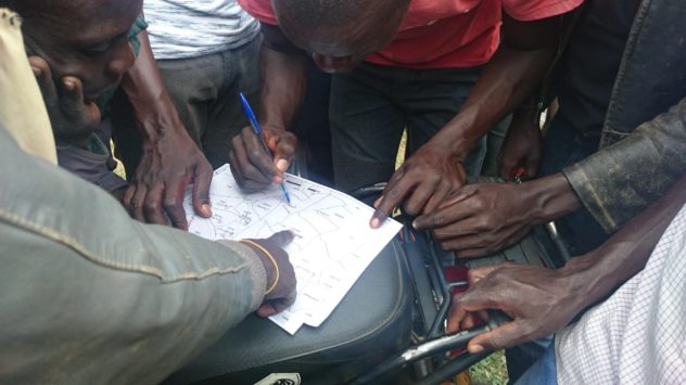
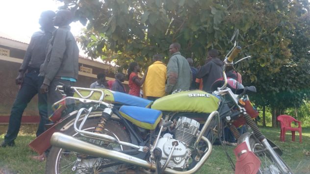
Local Boda Knowledge – Riders are involved as team members
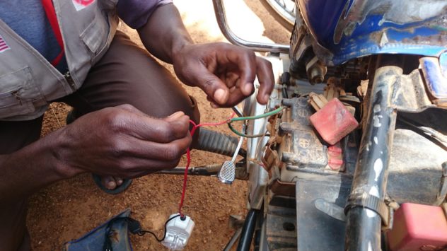

‘Hacking’ Motorcycles with Phone Chargers

Training Outcomes
In order to provide the most accurate mapping data which can be accessed both by agencies across sectors and a growing OSM user community, our field mapping content, ground-truthed by the community members themselves, has been interwoven with training in OSM data manipulation and GIS tooling during this time. Mappers from the community have now experienced all aspects of taking data from the ground to the Humanitarian OpenStreetMap, and partners have acknowledged the value and power of the OSM tools and methodolgy.
Locally, refugees habitually now work alongside host-community members in the field (local community surveyors, and local community motorcycle riders), who guide them and translate in non-settlement situations. These Ugandan Nationals themselves learn and interact when navigating/mapping the inside of the settlements.
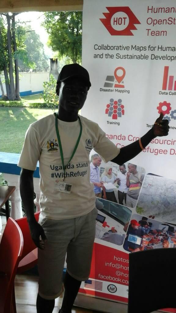
Michael Yani, Refugee Field Mapper, learning GIS in the UNHCR Compound, Arua

Newly-Established Arua OSM Community.

Since commencement of this phase of ‘Uganda Community Mapping’, we have trained over 75 people in Missing Maps/HOT Field Mapping Techniques, OSM field tools, and desktop GIS and Data-Processing skills.
These people constitute the newly-founded Arua District OSM Community, which has a WhatsApp group by which to communicate, and which is used as a resource for ongoing events. 16 of these members were selected for field-mapping in the district, and consist of six Refugee Community members, five Local Hosting-Community Members (Ugandan Nationals), and five independent partner members (from MSF/France and CARE International).  This group also communicates and coordinates by WhatsApp, and can be remotely and internationally supervised and connected on this platform.
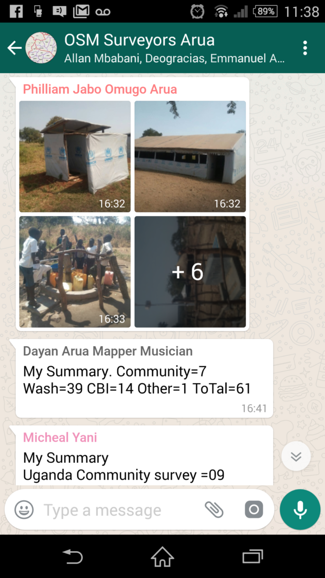
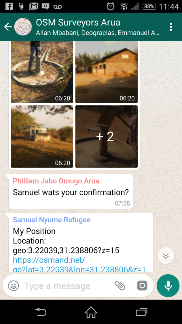
Mappers share daily progress via WhatsApp

We have also involved UNHCR partners to help coordinate and for community entry. The careful choice of ODK enabled the generation of much interest in the project, due to the power and accessibility of ODK, and its adaptability as an access-point into OSM culture as a whole. Partners without OSM knowledge could easily see the mechanism of Community Mapping as it evolved, producing a working map which could be imagined and understood as surveys appeared on the server and then were used to make focussed map products:
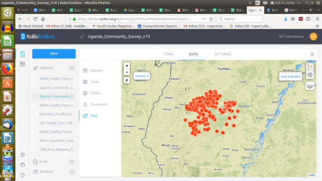

Surveys arriving directly from Field to Server, ready for analysis, cleaning, and OSM uploading (24 hour process)

Embedded Trainings
Around the workshops and trainings, many inter-agency relationships were built, which can potentially serve to reinforce the developing OSM culture in Uganda at national level.

As a result of these practical sessions and field applications, provisional agreements now exist for further partnerships and collaborations with many interested parties. One meeting at UNHCR resulted in the adoption of ODK for field surveying in an immediate project. This demonstrated the potential value of providing partner agencies with embedded training sessions, under the condition that they adopt OSM as everyday practice, serving, and integrated with, the collection of their data. It is hoped that these trainings will remain firmly attached to the community-led way in which the mapping data is collected, and the culture of enterprise embodied in the intrepid commitment of the data collectors themselves.
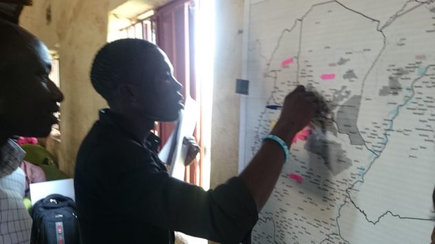

Training and Orientation: New OSM Arua Members finding their homes on the evolving map
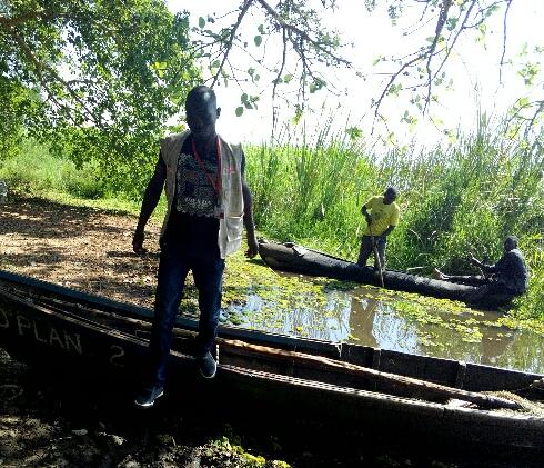
Refugee Surveyor Moses Mawa making full use of the HOT Uganda Mission Order

Additionally, steps have been in the sharing of previously inaccessible data, in contribution to, and benefitting from, the HOT project in Uganda. MSF, REACH and UNHCR are now each running surveys which use our tools and surveys/data models, and trainings and collaborations have been specifically requested by World Vision, IAS, IRC, CORD, World Vision, URCS, and LWF.
Outcome: Partner Access.
Challenges of partner access are tackled firstly by merging proven HOT methods and OSM techniques with locally-found ‘lowest common denominator’ technologies which are already in use (hence the prevalent use of ODK, already a universally NGO-accepted intervention/survey tool). Contributing partners were reassured of the fact that the OpenStreetMap only makes simple geographic data points public, that demographic, political and sensitive data is separated, but that this can be used in an aggregated way to make some powerful analysis. Confidential, sensitive, or inappropriate data is separated, protected, and anonymised at source.

The Evolution of a Community Map is a Stepping-Stone to further advocacy between agencies and within LC and RC communities, upon which to build the next phase of the project – Expansion into Arua, Yumbe, Moyo and beyond.
Monitoring of Most Appropriate Tooling
OSM tools in use are expected to change, and it is important to keep the methodology under constant review. There are many lo-tech and hi-tech OSM tools which ‘hack together’ for crisis-mapping in each context around the world. For tooling use monitoring, a monthly table is updated, with review points to note for accommodating the appropriate suggestion of other OSM tools (e.g. OMK, Maps.Me, OSM Tracker, UAVs, On-Foot Surveys)
Mapping Outcomes/Products
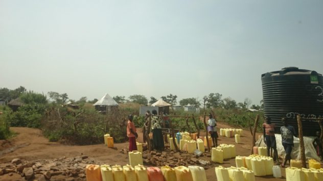

Congestion at Water Tanks – The Majority of Geo-Spatial Data are WASH Interventions also used as an Address/Location System

The most important function of a ‘static’ map product which is not the dynamic OSM online map is for use in community centres to gather feedback and detail from interactive community use. It is hoped that map products such as the following draft – a rendering of training data gathered in the first phase of mapping – will be printed-out and displayed, to create a reciprocal understanding that community members can change how their surroundings are viewed and understood by becoming involved in community mapping. The process also serves as a live example of how OSM globally connects communities through commonly understood spatial language.

Click for Interactive Map: Data gathered at 20th January
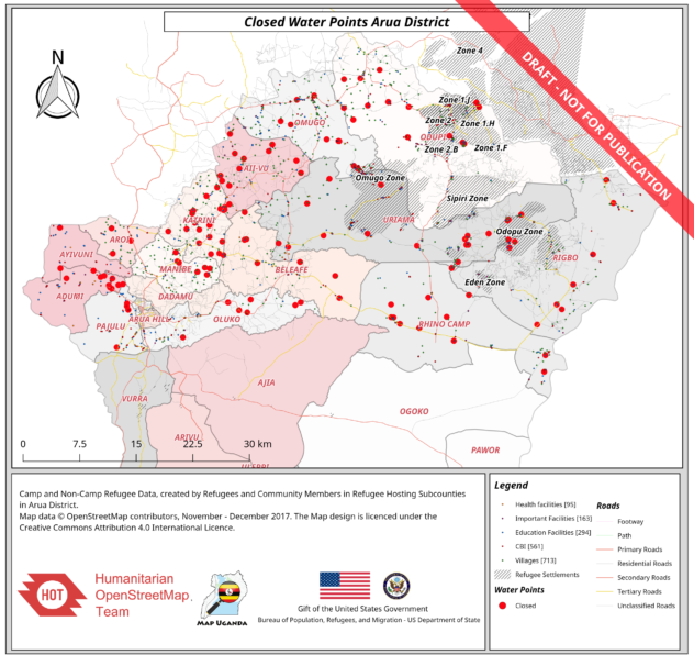

12th January, 2018 Full-Data Map, visualising ‘All non-functioning Water Points in Arua Hosting Subcounties’.

In the two and a half weeks since field and classroom training started, well-over the recorded numbers have joined the OpenStreetMap community, many have been trained, and many have agreed to provisional collaborations, some of whom have already adopted OSM into their data collection work, and are now gathering OSM data according to our agreed model. The statistics speak for themselves, but are only supported by the continued field-reality of communities getting mapped, and indicators of needs in service-provision being logged. The sustainability of the community and this project itself depends upon these transparent lines of direct beneficiary-to-donor communication being maintained through continued mapping, embedded and public training follow-ups, and ultimately effective and economic intervention being evidenced as a result of the new geo-spatial coverages achieved.

Conclusion
This method of data collection amongst communities in the field integrates important local content with the trainings. It provides both content and incentive at a local level to learn and apply OpenStreetMap through practical mapping of needs and personal skills education. The partnerships derived from these collaborations are multi-lateral, with members of the Refugee Community working alongside NGO partners in trainings, and reciprocating knowledge and skills between the data management process and the field.

 

Humanitarian OpenStreetMap Job

We are looking for a ‘Sundance’ to my ‘Butch’, a ‘Robin’ to my ‘Batman’. Please read, share, and apply. This is an extremely exciting job which is literally about changing the world.

I have ended-up in Uganda, in charge of HOT’s operations here amongst the refugee settlements in the North. The local and international community are trying to crisis-map the facilities, amenities and community needs amongst the rapidly-growing south-sudanese refugee settlements, one of which, BidiBidi, is the biggest in the world.

https://www.hotosm.org/job/information_management_officer_uganda/2017

Hurricane Irma Call to Action

Hurricane Irma Clean-Up

To all those with time and willingness to come down to Florida but wondering, as I did, how to be part of the solution rather than the problem, I thought it might be useful to write a few words.

I watched the weather avidly as I was flying into the northern US as Irma was bearing-down on the Florida Keys. It was weird to attend a disaster mapathon at OSM Canada, and hear people discussing buildings and features of my beloved Boot Key Harbour. Live-aboard lfe in the Keys is another part of my life, which seemed remote from my work in Africa, and it was eerie to think of places like Sister Creek and Big Pine Island as disaster zones to be mapped.

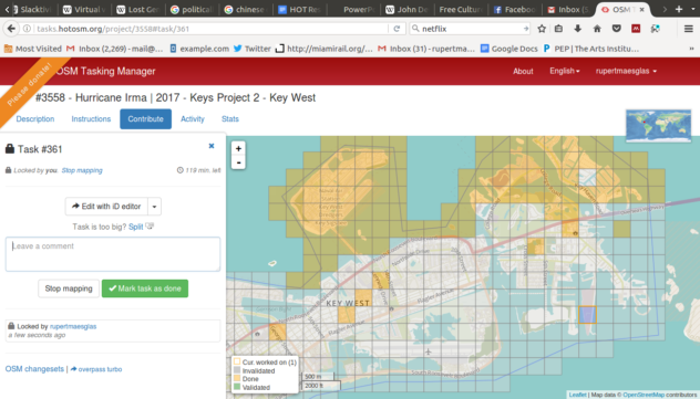
Community Mapping Florida Keys Disaster Zone – Screenshot from a Mapathon
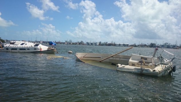
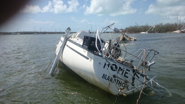
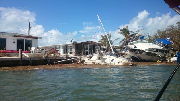
I thought I should come down self-contained, and knew, in fact, that I might be more useful within the local communnity, rather than as part of an NGO relief intervention which might, or might not, reach the communities who really needed it. But how to have a low personal impact? I miss the Keys, and was concerned for the place – so devastated by the 1932 hurricane – and my friends. Since arriving, I have discovered that not one of my friends did not lose their home. Some have found them again, washed up damaged, impossibly high in the mangroves or well inland. Many have never seen their boat/home since the storm, and now don’t really expect to ever find it. None of it was due to their bad seamanship and preparation. There is a hint that some people were unprepared. One boat with the sails left on, or badly lashed-down, can wreak havoc as it hurtles through moorings and anchorages, taking well-secured boats with it. There are huge efforts going-on to raise not only boats, but houses, too, from the sea-floor. Huge inflatable bags are pumped full of air down below, slowly bringing these structures to the surface where they can be floated into shallower waters.

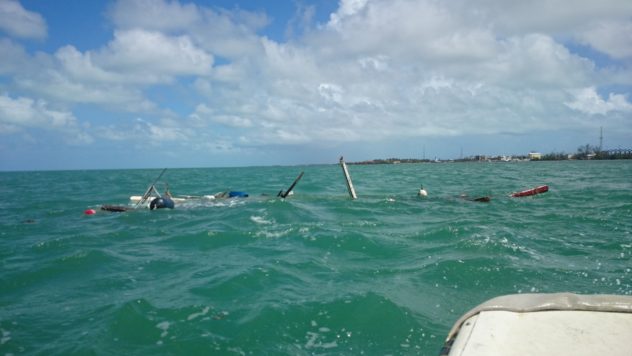
Boats lost and broken in the harbour and out to sea.
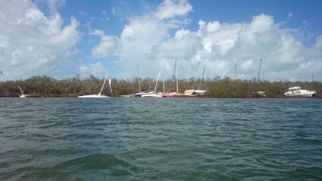
‘Kettling’

How could I be effective, if people didn’t know my skills already? I hired a car. Boat-people are often short on cars. I shopped for enough food and water to be self-sufficient, and a sleeping bag; I could sleep in the car. I got in touch with a few boat-folk on facebook, and finally got the message back that there was a job for me, helping with supply. So I came.

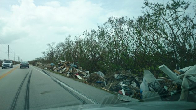
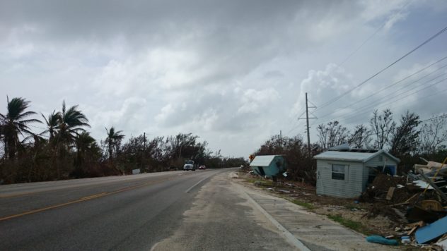
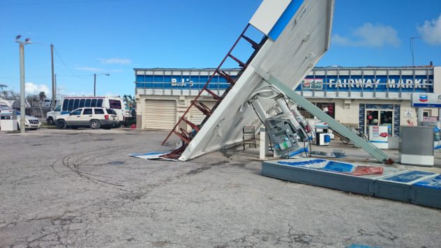
The way down USA Route 1 and the Overseas Highway was littered with evidence of the storm, from Miami down the next two hundred miles or so. A friend, Diana, had hooked up with a church community. I made a beeline for here, and on the way another friend, Charles, got in touch, saying there was another place to stay. Nobody needs food or water. Not really even building materials. The Government and Non-Government agencies have showered the Keys with these. But they do need helping hands. People. Possibly more in the coming weeks, as the focus turns from Keys Recovery efforts to other current crisis elsewhere. Willing hands are needed. Easy-going people who can lend a hand and are accustomed to putting themselves to work are very-much still needed.

Many of the still-working hostelries are taken-up with FEMA workers and other charity groups. But it was initially unclear to me whether I could help. At the church, the main body of work is led, unsurprisingly, by sailors. Sailors live much of their time in crisis, and know how to focus on the important practical things. I spent the first two or three hours here clearing out an old thrift store which had lost some of its roof. Mould climbs the walls very quickly here. The water-logged carpet squelched as I moved around it, pulling out masses of heavy filing cabinets, stacks of sodden paperwork and waterlogged cheap office furniture. It was straightforward but not glamorous work. Perfect. Yesterday, I went with another volunteer to tarp-over a roof with nails and duct-tape on a parishioner’s house which again had lost some of its roof. It was windy with another small storm, but we worked in the sun and gusts to get the tarp nailed down.

Business as Usual

Today has been reconstructing docks, clearing a crumpled mass of metal sheet which was once a shed, some tree surgery too. There are a couple of places to stay in the church hall. But these people can’t afford to offer accommodation until they know how effective somebody will be. They are refugees themselves.


Out in the Gulf

However, I had my car, and never needed it yet. The community spirit of the Keys couldn’t be stronger. ‘Welcome Home, Keys Strong’ was the message sprayed onto a plywood sheet as I crossed into Key Largo from the Mainland. Everybody is gathered, Florida-style, in shelter, around a big table, passing round rum and moonshine, and disappearing periodically to attend to a fallen tree, a smashed house, or a boat-recovery project. Hot showers are not a feature. But they don’t need to be. The main tasks are clearing and cleaning masses of foliage and household junk. The waste is phenomenal. But it is imperative to get dirty broken things away from living-space. For health reasons. A Northern hemisphere society accumulates material incessantly, and when this becomes detritus, it becomes hazardous very quickly. The Live-aboard community are the exception, and most treat the loss of their usually ininsured home – their boat – with a readily philosophical outlook. ‘The ocean gives, and the ocean takes away’. But they can inventorise every single item on their boat if pushed. One of everything. Many are living proof of William Blake’s maxim that ‘The road of excess leads to the palace of wisdom’. But that excess is an excess of life-experience. They are life-rich, material-poor.

Getting intimate

For many land-lubbers (‘dirt-dwellers’), this is a surreal new world of community contact and co-operation. For many a boat-dweller, this is just another big storm. The waves will keep coming, the trade-wind will keep blowing, and the days will pass. It is not 1932. Please get in touch with me if you need any guidance or opinions on how to be most effective. Organisation, construction, manual and legal skills are needed.

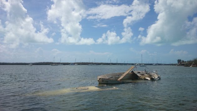
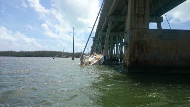
There are two other boats under the one visible…
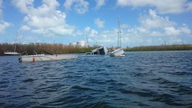
The houseboat may have brought some boats with it onto the shoals
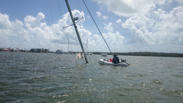
Waterworld: A diver retrieves a lifetime of personal belongings. A dinghy stands guard over the compressor lifeline.
 

John Roberts Farewell

J.P Roberts

I found out today that John Roberts died. He left us last Thursday. Driving through Downtown Washington D.C. in the baking heat, I had just finished bartering a second-hand folding bike for my hand-restored boat. I know how to fix this broken bike. I had the confidence to learn how to fix the boat, too, and then teach myself navigation over five thouseand sea miles around the Carribbean. I am known as a technician. Generally, I’m sure I can learn. I am sure because of John.

John was my childhood friend. When the bullies were excluding me, when I wasn’t number one in class, John was there in his workshop next-door in the ‘Back Lane’ at home. He was more interested in why the clutch wouldn’t fit into the engine of the 1920s vintage car that the family still drove around. Why the TVO, needed to start his 1956 Fordson tractor, was so hard to mix these days, and which meccanno parts I needed for my latest child-engineering experiment. He was twenty years older than me, but remained, throughout my life, ageless. He and his dad, Uncle Phil, had a ‘train room’ in the top floor of their house filled with vintage toys, ‘00’ and ‘Tiple 0’ gauge model railways round the room, and masses of intricate antique meccano.

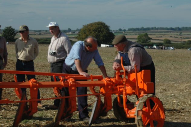
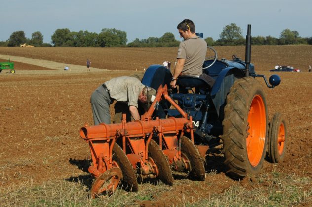
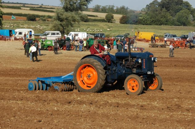
I was part of their family like I was part of my own. One of the earliest photos of my childhood has me standing in front of a big orange tractor wheel with a paintbrush in my hand, drippping orange onto the dust of the lane.

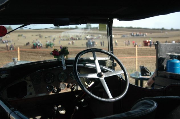
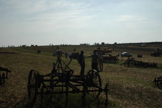
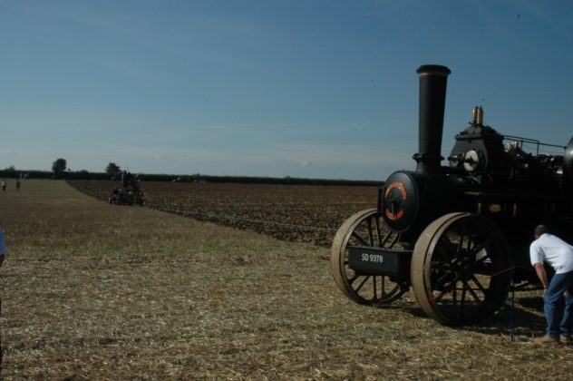
Later in life, John was to teach me to drive on that tractor, with its grinding gearbox and wrought-iron sprung seat. I was king of the world, and, at the ‘working weekends’ which John helped organise, run by the villagers and parish of Little Casterton, I was one of the only ones allowed to plough furrows alongside seasoned old-time Lincolnshire farmers, with their traction engines, cross-field cable reciprocating ploughs, and Massey and Internation lightweight harrow rigs.

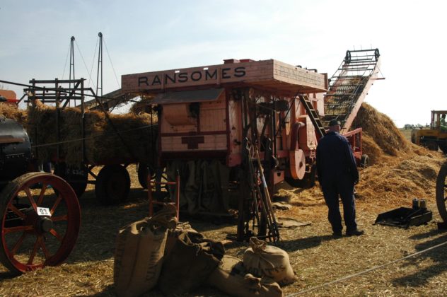
In the barn the vicar would conduct an outdoor Harvest Festival service, and the W.I. (Womens Institute) would gather alongside the ladies and wives of the parish to serve tea, scones, and finest home-made Lincolnshire sausages, while the threshing machines belched and wobbled dust and steam outside, and the Spitfires and Lancasters flew overhead (Uncle Phil, ex-RAF engineer, had friends in (literally) high places, who would orchestrate a vintage fly-by for the event.)

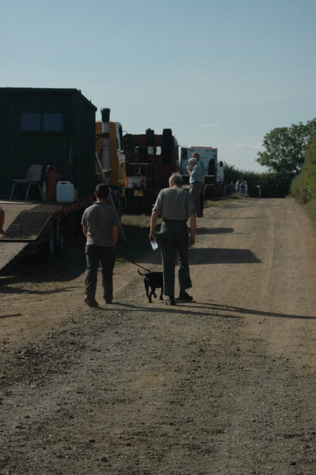
There were roadmens’ sheds, towed at four miles an hour behind the traction engines, assembling from across the huge county of Lincolnshire and beyond, and Lister, Blackstones and Atkinson well-pumps, sometimes retreived as four-ton lumps of limescale from Collyweston slate pits underground Lovingly restored, they would run impossibly salick and silent in their huge cast-iron piston workings, one stroke/bang every four seconds. But ‘Steampunk’- like the american term for lorry ‘truck’ – was not a word in John’s vocabulary. I never once saw a flat-cap which was accompanied by a fancy moustache or skinny jeans at Casterton. It just didn’t happen. It wasn’t a secret society. Not at all. On the contrary, it was a free-for all for enthusiasts. Dogs were given water-bowls, we ate cakes and sausages, and there was no craft ale in sight. But it wasn’t digital. It was a yearly catch-up, and alongside the low-loaders and painted and polished ironwork, old farmers would lean on the idle ploughshares of their forefathers, kicking the mud off, putting the world to rights, and baring their souls quietly in the afternoon sun to eachother. John and Phil, Arthur Hinch, and the legendary Knight family, had put the event together lovingly for just this to happen, it seemed.

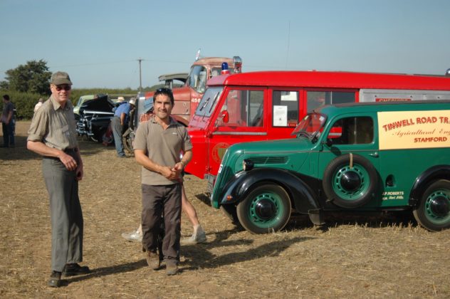
And I was always an honorary member. John taught me everything he knew, and as I started buying old cars of my own to restore, he would be just down the lane with tools and know-how, keeping a brotherly or paternal distance, and allowing me to make my own mistakes. Eventually, he had me panel-beat dents out of a fifties Fordson Dexter front-grill. ‘You’re the only one I would trust to do it right, Master Rupert’, was all I needed to realise that I was starting to be able to hold my own in a world of engineering experts. I had a long way to go, and looking back now, it seems I have come some of that way. ‘Things should be used’, was Uncle Phil’s motto which he passed down to first John, then me. ‘They shouldn’t be in museums, they should be getting dirty and dented in a field or on the road.’

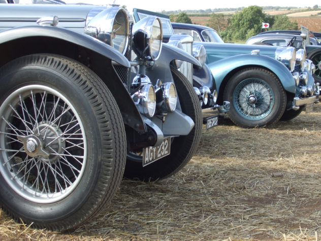
The family continued to go on holiday in the long black 1924 Cottin Desgoutes Sedan they had. People would ask whether it was a Rolls Royce, whenever I had the privilege of being part of the passengers pulling-up at the roadside. It was the only one in the world, was what I knew. They had once found anothor, different model in Australia, and when they found a ‘Cottin’ entry in some old ‘Observer book of Motorcars’, it turned out to be their very car in the photo! An aluminium (unusual for 1922) body on an iron chassis.

Uncle Phil had rescued it from a scrapyard in the early 1950s, as I was inspired to do with my first three mini-vans (Austin and Morris mini, not BMW – perish the thought!) There was nothing wrong with it that a bit of ‘elbow grease’ couldn’t mend, according to him. Phil had replaced the engine with a WW2 ‘Lorry Engine’ in my early childhood, and the iconic vehicle had sat in their wooden garden shed-turned garage/workshop under covers until, finally, with high excitement, it was recommissioned. I was one of the first to ride in it. I was engaged in building a mechanno steam-car at the time, and Uncle Phil was helping me figure out the parrallel steering. I was eleven.

Somewhere around this time, I became ‘Master Rupert’, and John became ‘Mister John’. It was a transition between childhood and adulthood which we negotiated through comedy ranking. My sister Juliet became ‘Miss Juliet’, and ‘Master Bruce’ was my best friend and accomplice in all disaster-making, technical and otherwise. I think we had first decided that there was a military ranking, but this didn’t stick so well, although I still sometimes referred to him as ‘Field Marshall’. But John wasn’t any kind of class, rank, or superior person. There was no consciousness of this in him. Some of his best friends were old ladies who he diligently supported, gaining life wisdom, giving lifts, help, and entertainment to, and broadening, in lateral ways, his understanding of times gone-by, when his beloved machinery was in its heyday.

Stamford has a mid-lent fair. It is famous in its own right for being possibly the only town fair which has run continnuaously from the early middle ages until now without missing a year. As children, it was the highlight of our year. I went there as a kid, as a pubescent, and as an excruciated awkward teenager, looking for the girl of my dreams in the lights and whirling. But countless times – the most memorable ones – were spent walking down with John. We didn’t ever even see the stalls themselves, and what they were peddling, or the fun they were mechanising. John would make a beeline for the generators, power units, and lorrys which towed and powered the rigs. Atkinson, ERF, and Seddon, as well as Scammel and Ford populated his mind. But his one great love, apart fromn the buses and their history, of which he had a huge knowledge and massive collection, was the Foden lorry. Indeed ‘Foden’ was one of his last words, in the jumble of what must be the scariest hours in life.

We would pick our way through Gardner and Cummins power units – running sweetly and providing a livelihood for the showmen and their families year after year. Consumate professionals, clean engines, greased cogs, griease-smeared faces, tattered clothes. But when we would find a Foden, John’s eyes would light up and the stories and history would flow. He was a scholar on the subject, and the master of quite a few histories. But he never repeated himself. He knew what he had taught me, and I took pleasure in demonstrating that it had sunk in. He was an ambassador for technology, but he had a strong belief in people, and he knew, somehow, although he NEVER spoke about it, that we were all going to better place in the end.

And I used this knowledge too. I didn’t run away with the fair. It did occur to me, but instead, hitchiking around the UK and Europe in my teens and twenties, the lorry-drivers would be impressed that I knew their rigs, the challenges they were facing, the technical decisions they made to keep going. I would get dropped-off that extra mile down the road; they would get on their CB radios and organise another lift from the next truck-stop, ‘going my way’. I would even doss-down in the cargo once or twice, if I was in a pickle. The ‘journeyman’ life was something that stayed with me. Touring theatre shows, humanitarian relief-work, and international film work were all informed, for me, with the working best-practice which John instilled. Clean up after yourself. Leave things better-off than you found them…

John once joked to me: ‘the only bright lights in Stamford go like this: Red….Amber…Green…Amber…’ after I had returned from some foreign clime or big city. But John was one of my brightest lights in my life, and for others too. We are all continuously and forever indebted to him and his humble brilliance, approachability and wit, as well as his enthusiasm for life, improvisation, and people. He will be missed in many places, by people who he never heard of, but who have hopefully benefited through the work of people he inspired. I only hope that my work, which was so fundamentally inspired by him, has done him justice.

As well as me, his friends and his later-life love (after Foden lorries), his wife Leslie(!), John leaves behind him a 1948 Fordson Major, a 1924 Cottin Desgoutes Sedan, a 1972 Jaguar XJ6, my 1969 Morris Mini Van whose ownership we tag-teamed over two decades, and various other beautiful and unique objects, all of which he made sure went to good homes before he died.

For me, he leaves behind a lifetime legacy summed up by D.H. Lawrence in a poem I often quote:

Things men have made with wakened hands,

and put soft life into
are awake through years with transferred touch,

and go on glowing
for long years.

And for this reason, some old things are lovely
warm still with the life of

forgotten men who made them.”

One of John’s favourite voices was that of Sandy Denny, who can be heard singing a favourite tune HERE: FAREWELL

John certainly left me better-off than he found me. God-speed, Mister John. Mind how you go.

(All Photos Courtesy of ‘Master Bruce’ Charlier)

JHP Allan ‘Leaf’ by Niggle.

My dad, beautifully reading a poignant tale of visionary humanity and excruciating humility, a few years before he died. Written by one of his old lecturers at Cambridge University, J.R.R.Tolkien. I still have his lecture notes, and some from C.S. Lewis and F.R.Leavis, too!

Hugh Allan Leaf by Niggle JRR Tolkein