‘Kondewakoro…’. I say it out-loud without meaning to. The young lad responds in Krio. Ahmet translates, although I’m starting to understand Krio. It is what I thought:
‘He says still three hours. 16 kilometers.’
We don’t have time. We have to turn back, but if I’ve got it wrong, there will be nowhere to stay back where we came from either.
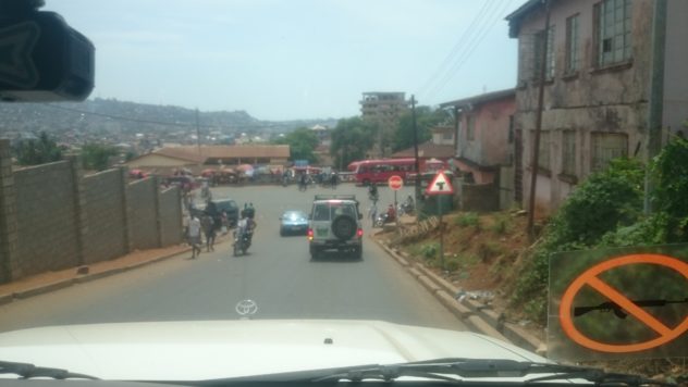
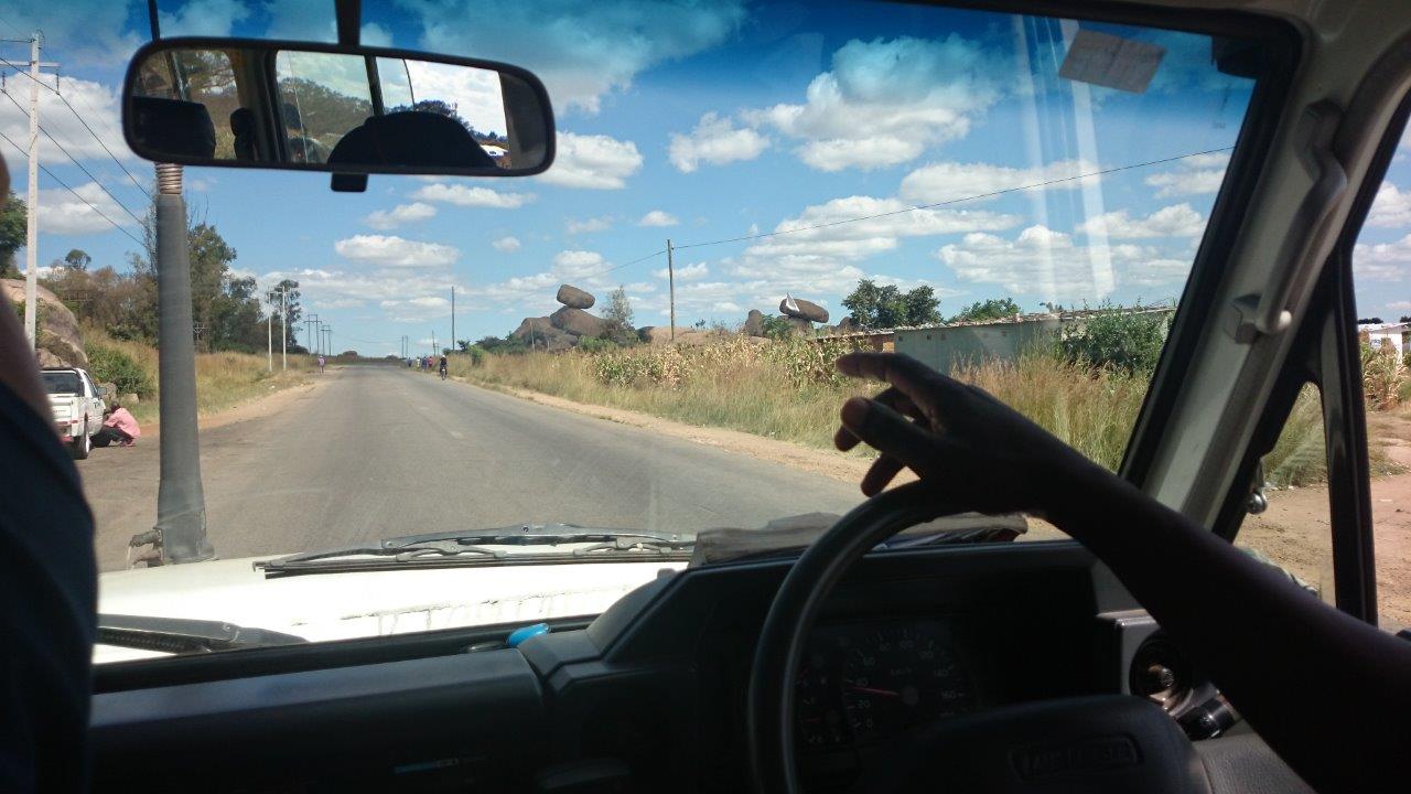
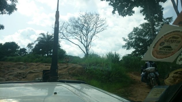
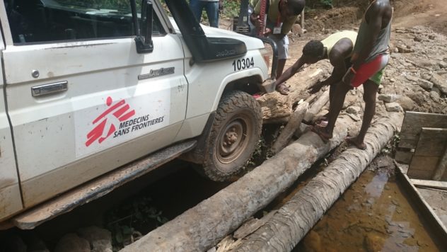
Kondewakoro is a border village in the far reaches of the Toli Chiefdom of Kono District, Sierra Leone. AKA ‘Diamond Country’. On OpenStreetMap, the only map of this corner of Africa, the road we are on shows as a decently defined yellow line. In England or Wales, it would be a tarmacced trunk road. We are not on tarmac, though. No, these roads, for all their ancient status, are not even really roads, more determined cuts through the bush.
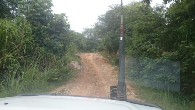
The Guinea Highway
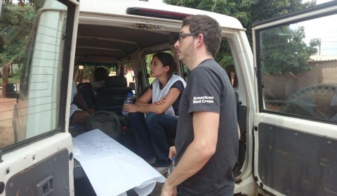
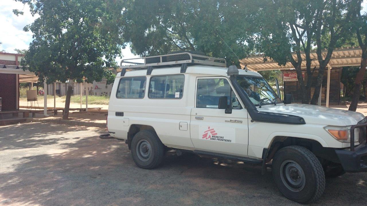
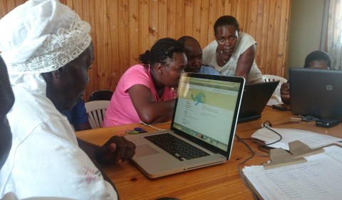
I am attempting to track down Sulaiman Charles, the teacher, but am wondering if this is a wild goose-chase all these hours down this bush track in ‘Zulu One-Five’, our trusty and iconic MSF Landcruiser. Getting battered about hour after hour, rock after rock, river after river. I have learned to trust Ahmet’s driving through these unlikely passages. I made an arrangement with Sulaiman to meet on the road to Kondewakoro over a broken phone conversation more than six hours ago. Sulaiman is an energetic spokesperson, a brilliant teacher with presence and vigour. He is one of my Field Team Leaders, in charge of six Sierra Leone Red Cross volunteers who are methodically surveying the missing, mis-named, and un-represented villages of the border region for the Post-Ebola Community Rebuild project. Spearheaded by Missing Maps (American Red Cross, MSF, Humanitarian OpenStreetMap), it is a fundamental vulnerability assessment of at-risk areas where epidemics and natural disasters can run and spread for weeks un-checked.
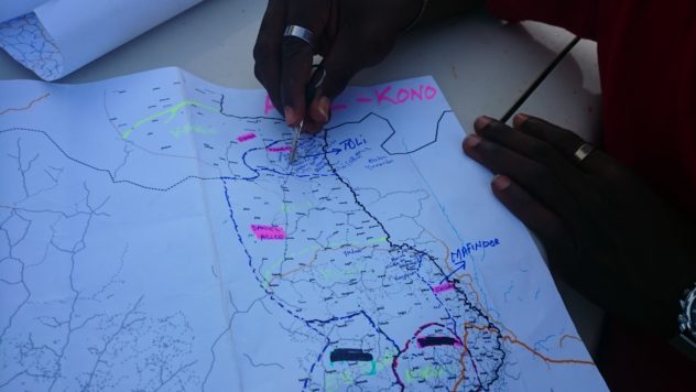
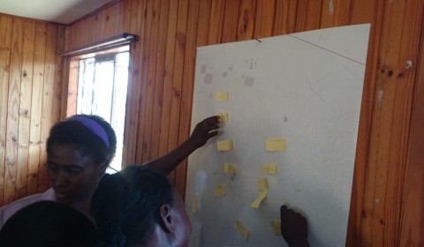
Working the Map (Sulaiman’s Chiefdoms)
We are here to correct the map, or more accurately, to leave the capacity for the inhabitants of Toli to map themselves. We have trained four other team leaders like Sulaiman – the best and brightest that the national border regions have to offer. We have also been training a cohort of supervised volunteers. Trained them in the classroom. But this is the bush. And now it is a question of finding them, as they map what can’t be mapped, and we, hampered by the very resistance factors which have prohibited this mapping for so long, are trying to support.
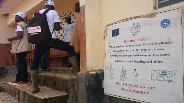
Volunteers Putting the Health Centres on the Map in Koinadugu District, aka ‘The Land of the Powerful Mixture’
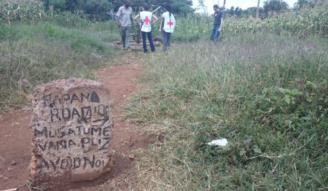
In another chiefdom in the North I came across a border crossing into Guinea made of rickety palm-wood bars. I was reluctant to ‘snap’ the sleepy photogenic border-guard in his vest, standing under the words ‘Immigration’ pencilled on the flaking cement above the’office’ doorway. Things can escalate easily here. There are strict security protocols, and the sensitivity of this ‘porous’ borderland domain dictates that we follow strict MSF radio-contact schedules. We are in two-hourly contact with the radio-room in Freetown. A day away. Now, I would like to meet Sulaiman at the border, but we have a lot of ground to cover, and a six o’clock travel curfew to observe. This is no-man’s land. I am aware of the need for caution.
And here we are with this young biker now, deep in the forest, on the way to Kondewakoro. His chinese-built 125cc road bike has toppled, as he has tried to come up the impossible rocky slope which we, somehow, are attempting to go down. He is laden with six large jerry cans of cow milk, but amazingly there has been no spillage, and we help him re-tie the load. The motorbike is low on its suspension, and the sweating rider is using all his bush-riding skills to snake the bike between the rocks, load and all. But where is Sulaiman? I note that he is young. Young enough to have recently been in school. As we help him get going again, I have a last-minute thought – he might know Sulaiman.
‘Red Cross Motorbike. Sulaiman the teacher. Have you seen him this way?’
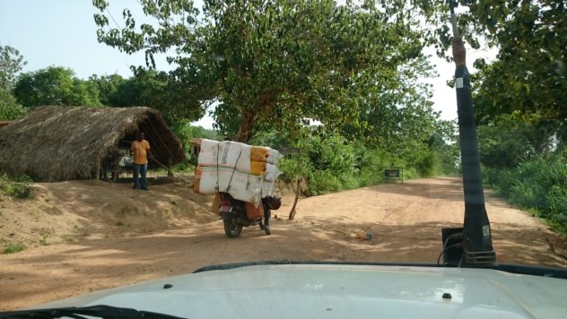
How to Load a Motorbike
Imperceptibly he nods, and says something. Ahmet interprets a Krio mutter and throw of the head.
‘He is here. Up ahead.’ A huge grin. Somewhere, down these rocks, through the next river, we will find him. Ahmet is visibly relieved. I knew I could trust Sulaiman, my ‘brother from another mother’, he has called me in the training sessions. But I’m relieved too.
‘…and is there another road?’ No. No other road. This is the only way to Kondewakoro. We get back into the Landcruiser which flops down the track between the boulders. It doesn’t feel possible yet, but we have somewhere to stay tonight. One hour to go until curfew. No turning back, but now it is certain that we will find him.
And ten minutes later we literally almost run-over Sulaiman on his motorbike. Komba, the isolated volunteer tasked with this spur of the project is interviewing the Village Chief in a clearing. It turns out Komba is a star surveyor, with an amazing grasp of the job in hand. It is difficult to deliver the detailed survey, with its questions about water availability, its carefully crafted cross-referencing of Sanitation and Disease questions, road conditions and Healthcare access. But it has been worth coming to see how it is done properly.
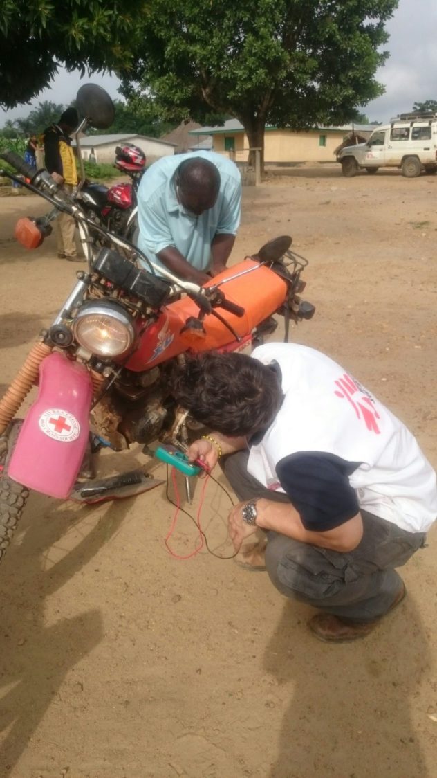
Missing Maps Field Consultation: Wiring Motorbikes to Charge Phones
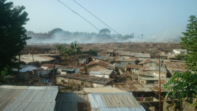
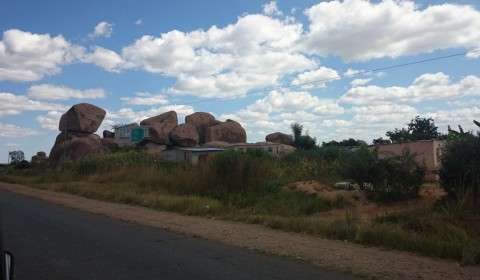
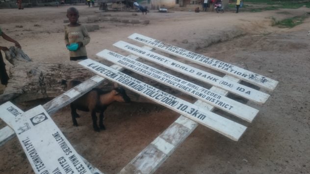
There has been a ‘Loma’ Market here today. It has been a hive of activity. As I look around this village, seemingly thriving in its own right, I can’t help wondering how on earth some of this actual concrete came to be here, given the impossible nature of the only road in. It will be a long time before these villages have convincing vehicular access, despite the fact that they are located on this footpath they call ‘The Guinea Highway’. This track, for better or worse, protects this village in some way, from invasion, but at the same time makes it vulnerable to a changing world around it.
Ooops
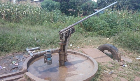
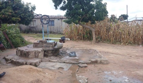
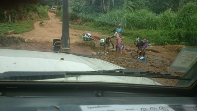
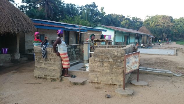
As we photograph wells and water sources, with different surveys, the bigger picture which emerges is the sparsity of consistent water, and the dangerous propensity of water-contamination at source. Villages look well-ordered sometimes, but once surveys start to show exactly how many people actually use the water-sources, how often they dry-up, and how close to latrines (another resource we survey) they can be, the data starts to tell another story; desperate need and hard-boiled living in this disowned and precarious border area. I later geo-photograph two pumps in Kpetema – an ‘India MkII’ and a ‘Bush’ Pump. Neither of them dries up in dry season, which makes Kpetema regionally important. We have come across several villages where women are washing in the ford we are crossing, and children carry water from the same river up the hill for drinking.
These communities are susceptible to so much disease from so many quarters. When disaster occurs, their location needs to be traced. Whatever way the locals want it, it needs a name – particularly when some desperate community mobilisation team in the capital receive a dying patient and are trying to pinpoint the place they came from. Local names are important. Geo-tags are critical. Terror spreads as fast as the epidemic itself in these communities, and there are many instances of death resulting from panic as well as actual disease. The enemy is the unknown.
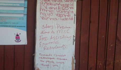
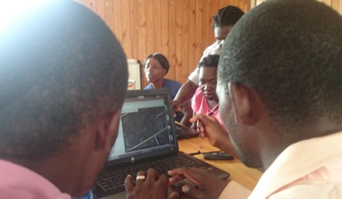
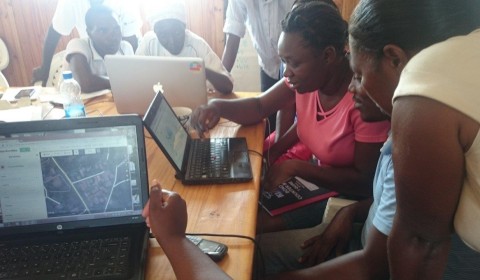
It is the end of the day now, and gaving gathered for council on wooden benches, and sat through typically long-winded introductions with Mami-Queen and Chief, solemn nods were closely followed by furious handshakes (post-Ebola protocol thankfully now permits careful physical contact) and gentle curiosity. Part of the meeting ritual involved the explanation of the corrected name of this village. It moved because of forest fires decades ago, so what I have on my OpenStreetMap, ‘Kekeya’, compiled from old military or colonial data, needs adjusting and renaming. The Chief and the Youth Leader peered curiously over my shoulder as I renamed the village on my phone screen. Approving grunts at me spelling-out the proper village name give way to open-faced enthusiasm and laughing recognition of Chiefdoms and Sub-Chiefdoms so carefully researched by our team and now so available on our own ARC-developed OpenMapKit App.
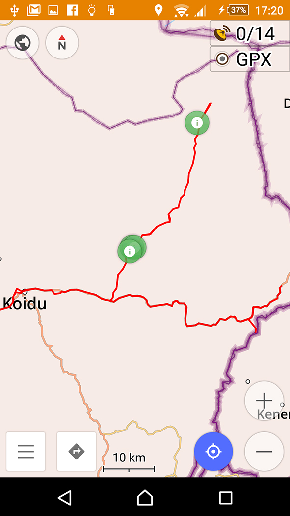
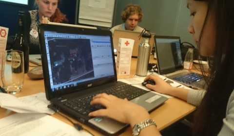
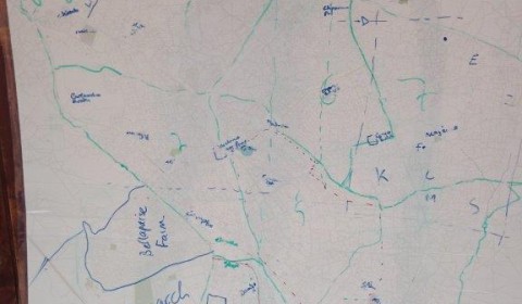
Screenshot with my GPS tracks from OpenStreetMap on Android – The Everyman SatNav.
It has already been established that I am the evangelist in my team, and the people here, perhaps more than a proprietary-thinking western audience, get the publicly owned ethos of our OPEN StreetMap. Our data tools are not concerned with this one-time survey event. Our tools are what you could call ‘culturally scaleable’. They can be used by anyone who understands them, anyone with an android phone, and what we are fundamentally here to do is to spread the word. ‘Communities, map yourselves, on your own terms, [Arguably] before you become mapped by outsiders…’, is our message. This is the OpenSource Global Digital Revolution which can empower the marginalised across cultures.
And now the dim shape of the Landcruiser looms in the gloaming as I look out into the village from the Out-Patient’s waiting bench. Night is falling. Ahmet, my driver, is preparing the Landcruiser for the night. The sound of crickets and other forest insects almost drowns out the quiet african consonants being murmurred over food amongst the houses across the track. The cool crescent of the moon is a welcome sight beckoning the forest woodsmoke to rise and meet it. In another part of africa it has celestial pageantry which I know. I wonder, through the dusk, how they read the stars here. The old navigation envisaged by the new.
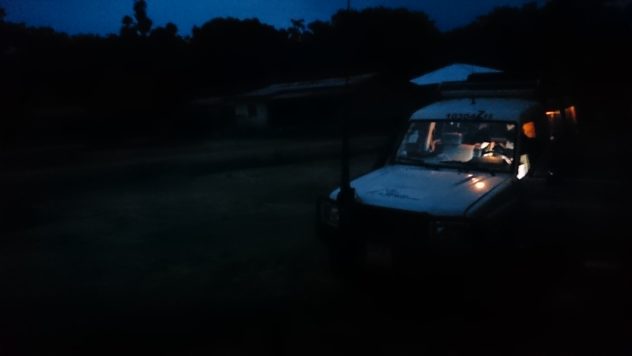
I shall sleep in the mud-built health outpost tonight. The nurse cooks under the palm kitchen roof, and I am sitting, fresh-washed and waiting for what will turn out to be a huge bowl of sweet rice and yoghurt. The pot is simmering on the fire already, gently steaming. I have done ‘Community Entry’. There are rules with village contact here, and society dictates that strangers initially approach the Chief. The performance of this tradition goes back in time, reflecting how outsiders have always been received into these isolated communities.
Later-on I lie under the mosquito net thinking. So: the terrain was too tough for even Zulu One-Five to make it to the border by curfew. Kondewakoro will wait for another time. But it is good to be here, and to have made contact with surveyors on their home territory. Despite the magic of mobile phone network when it is available, Sulaiman has made sure messages are sent through the traditional channels of communication (although drums here, it seems, are a thing of the past). Much as I trust the message of the digital innovation we have come to live by in the west, I know that tomorrow I will meet with Alice and Daniel for motorbike charging instruction and mapping survey technique and evaluation. Without fail.
The comforting village noises have given way to evocative night bush noises, and I drift off to sleep wondering who it was that first surveyed this village all those decades ago…