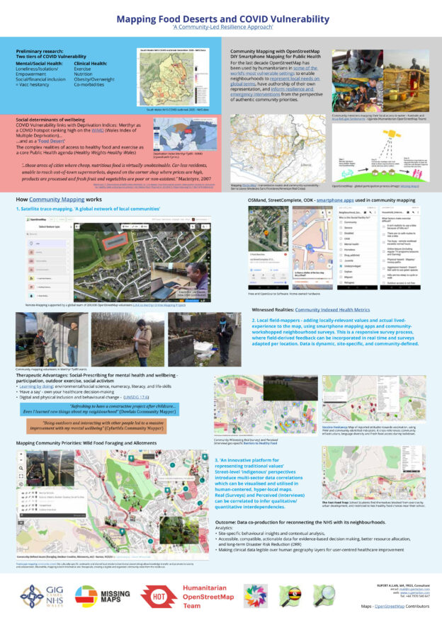
Featured post
Community Mapping Climate Memory on the Arabian Peninsular

The Digital Revolution and Arabic OpenData

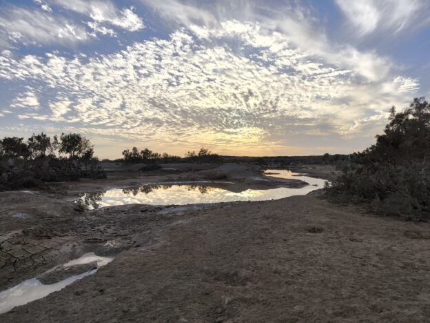
The Jordan ‘Community-Mapping Climate Memory’ project aims to help local people map how they and their livelihoods are adapting to extreme and accelerated climate change. In Al Azraq desert oasis, OpenStreetMap (OSM) is getting used to record cultural practices as a living archive of usable community assets. The project draws on a legacy of OSM Continue Reading »

Pioneering Community Open Mapping in the UK

Wellbeing, Resilience, and Food-Desert-mapping. With Humanitarian OpenStreetMap Team, NHS Wales and Missing Maps/Medecins Sans Frontieres. Community-led data helped to map wider determinants of Wellbeing, Co-morbidities, Social Exclusion and outbreak vulnerability. Reconnecting the NHS with its communities in the birth-place of the NHS (and of the Labour Party). We adapted Motorcycle Mapping methods previously used with Continue Reading »

United Statelessness and Counter-Mapping

Doctoral Research – Is all Geography Psycho-Geography? Exploring the post-digital decolonisation of navigation and plural cultural geography amongst Seafarers, Boatpunks and Refugees: Discussing blue ontology, recycling, and ocean citizenship in our era of global migration. Associated Publication: Chapter 29: The Routledge Handbook of Geospatial Technologies and Society This project embarks from the observation that ‘maps Continue Reading »

Mapping Land Voices – the National Library Sound Archive

Mapio Lleisiau’r Tir / Mapping Land Voices – August 2021 Stories of the forest sound archives: https://www.peoplescollection.wales/collections/1102166  Who knew that there were crofts hidden in the hills of my next-door village in Wales? I didn’t until very recently, when we started listening to the British Library/National Library of Wales sound archives collection. Dai Morgan, the Continue Reading »